ABOUT THE PROJECT

COASTS is a European project led by EOMAP. The project team aims to fill important knowledge gaps through the integration of earth observation, advanced modeling, surveying, and digital tools. It strives to co-design fit-for-purpose solutions together with local stakeholders at three pilot sites. Considering the crucial role of coastal areas for environment, economy and community, COASTS addresses the urgent need for action on pressing environmental challenges.
A focus on coastal resilience and blue carbon
Coastal areas, which embody a diverse range of ecosystems such as mangroves, seagrasses, and salt marshes are referred to as “blue carbon” ecosystems. They provide a wealth of ecosystem services and are known to be hotspots of biodiversity. However, climate change and human activities pose serious risks to coastal zones. This calls for informed management strategies.
Blue carbon habitats are also vital to carbon sequestration efforts: They play a critical role in climate regulation. However, they face increasing threats from sea-level rise, pollution, overfishing, and habitat destruction. The alarming loss rates observed in mangroves and seagrasses result in the release of stored carbon and degradation of key ecosystem services.
Leveraging Earth Observation (EO)
To address these challenges, the project COASTS (Coastal Observation Advances leveraging Space Technology Services) proposes an innovative solution: It will integrate advanced earth observation data with state-of-the-art modeling and monitoring techniques. This approach will help simulate past coastal processes and blue carbon ecosystem dynamics, thus providing forecasts and climate change scenarios. By leveraging the capabilities of the Copernicus Marine Service, the international initiative combines advanced technological resources with actionable environmental insights.
Decision support tool for coastal stakeholders
The COASTS project aims to develop decision support for coastal ecosystem resilience and blue carbon optimisation. For this effort, the team will evaluate the coastline’s capabilities in erosion protection, ecosystem services support, and carbon sequestration. Through the integration of high-resolution EO data, the project will map spatial-temporal dynamics within coastal zones. All data will be accessible to stakeholders via a web application, enabling for visualisation, analysis and environmental reporting. This critical baseline information and forecast scenarios will empower stakeholders to develop effective and sustainable management strategies for coastal habitats and better target restoration and preservation efforts.
Three pilot sites in Europe and the Maldives will provide testbeds for COASTS. These test sites will serve as a blueprint for application and scalability in other regions. The close collaboration with stakeholders in the pilot regions will ensure the project meets the needs and acceptance of end users.
Read the press release on COASTS’ kick off here.
More on blue carbon projects by EOMAP
We wish to support safeguarding blue ecosystems worldwide through further satellite-based habitat mapping initiatives:
- Recently, we have started to map mangrove coverage on the entire coastline of Madagascar.
- Blue carbon projects also include seagrass density maps for the entire coast of Schleswig-Holstein along Germany’s Baltic coast.
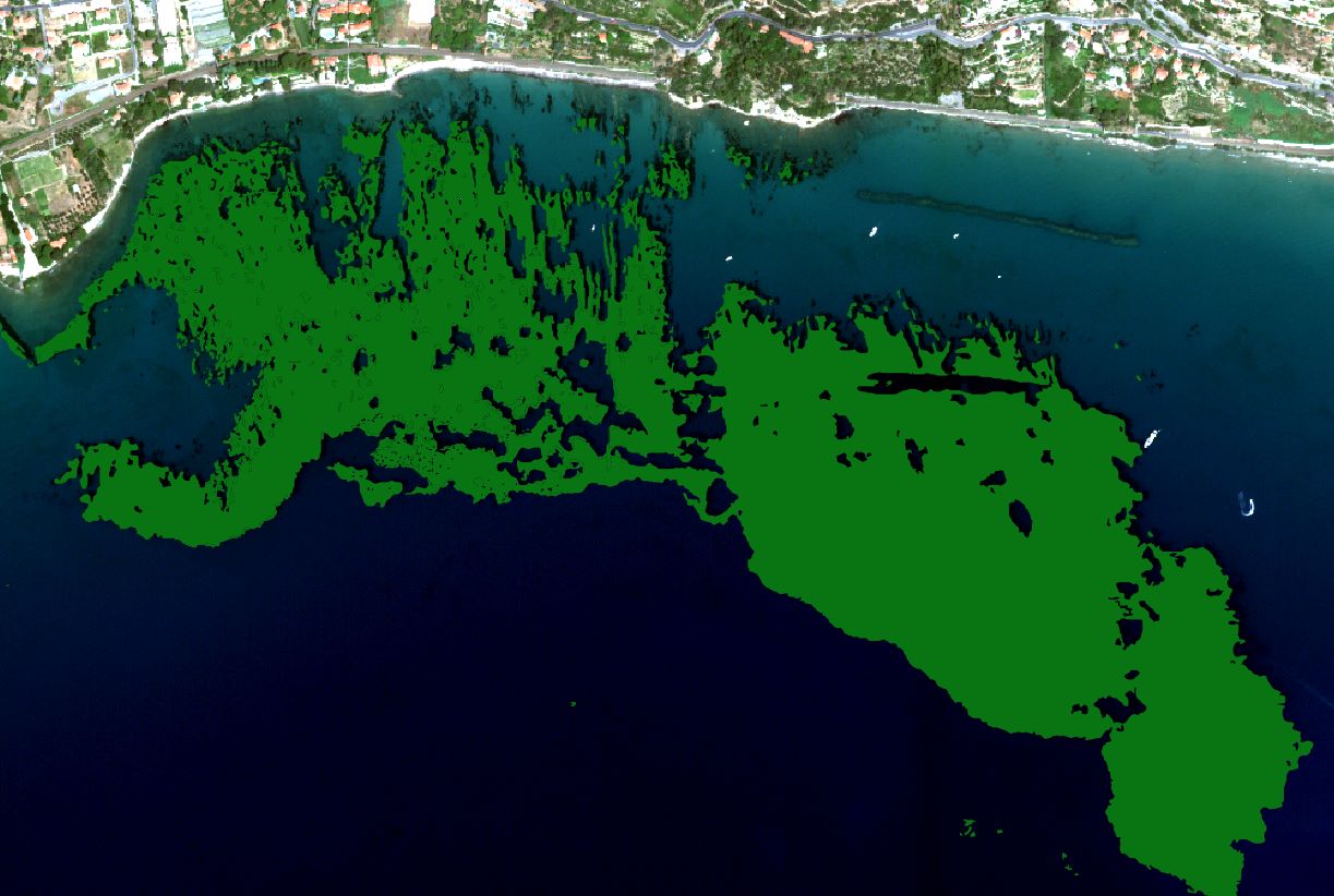
- Moreover, EOMAP has been part of an international consortium dedicated to mapping seagrass meadows along Italy’s entire coastline.
For more details, please reach out to our coastal team.
MEDIA

SUMMARY
Fugro, Maledives Space Research Organisation (MSRO), Submaris, EOMAP (lead)
Ecosystem Mapping
Satellite-Derived Bathymetry, Habitat Mapping, Seagrass, Mangroves, Blue Carbon