Satellite-Derived Bathymetry result of Dublin Bay, Ireland – c/EOMAP for S4
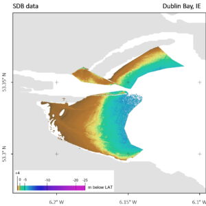
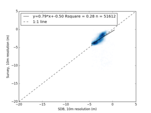
The following two figures illustrate the SDB results and the scatterplot of SDB versus traditional bathymetry survey data at the 4S use case in Dublin Bay, Ireland.

Scatterplot to validate Satellite-Derived Bathymetry against traditional survey measurements in Dublin Bay, Ireland. c/ EOMAP
Dublin Bay’s water clarity allowed to apply Satellite-Derived Bathymetry to map the seafloor down to 7.8 m at the time of satellite image recording. This equals to 5 meters below LAT, whereas the MBES survey data did not cover the intertidal depth.
Interesting finding: On this coastal site with higher turbidity, the combination of both surveys allowed for a seamless bathymetric grid from +3 meters LAT down to deeper water.