
Lake Okeechobee is Florida’s largest freshwater lake and a focal point for state restoration efforts. This story focuses on two contrasting years at Lake Okeechobee: 2017, when Hurricane Irma triggered a lake-wide turbidity event, and 2023, when harmful algal blooms were particularly prevalent – together illustrating how satellite-derived monitoring captures very different types of water-quality events at the same location.
A lake under constant pressure
Lake Okeechobee covers roughly 1,900 km². Decades of nutrient pollution, sediment disturbance, and storm impacts have driven recurring harmful algal blooms and declining water quality, with real consequences:
- Recurring beach and boat-ramp closures
- Toxin levels spiking far above safe thresholds during peak blooms
Satellite data closes the gap

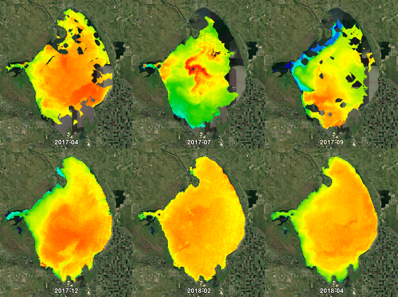
Sunlight passes through the water column, interacts with algae and sediment, and reflects back to the satellite sensor. A physics-based retrieval model turns that signal into quantitative water quality data, down to the Secchi depth, at up to daily revisit rates. When Hurricane Irma struck in September 2017, this approach captured the resulting turbidity spike within days and tracked its decline over the following seven months.
Short & Sweet
Florida’s largest freshwater lake battles decades of pollution and algal blooms. See how satellite monitoring tracked two contrasting crises at Lake Okeechobee, from Hurricane Irma’s turbidity spike to a major bloom event.
Related Use Cases
Water monitoring along the Zambezi
Advice4COASTS
Kelp monitoring in Los Angeles ports
Snowpower
Impact factors of oxygen loss on Elbe River
Catch-Mekong
Water Quality for Lactec Brazil
HYPOS
Lake Elsinore & Canyon Lake
Space-O

