Energy and Infrastructure
Blue renewable energy sources such as offshore wind, or floating solar have a high potential in times of the energy transition. Infrastructure activities need to be mapped and monitored along all phases, from planning and site selection to construction and operations.
Key applications in Energy & Infrastructure

Resource and site assessment
Earth Observation supports suitability assessments. It helps select the best sites for energy generation or infrastructure.
Resource and Site Assessment
Developers of new installations need to understand long-term environmental trends and dynamics to design fitted managements plans. This information is also a precondition for deciding on best-scenario locations for installations, such as hydropower dams, wind farms, or new coastal infrastructures.
Often little to no data are available and in situ-measurements are costly. Satellite data can help avoid these blind spots. Remote sensing data deliver both actual and historical data – from the early 1980s onwards – worldwide. The spatial coverage can encompass areas on a catchment or even larger scale, identifying impacts both up-and downstream of hydropower installations.
Access eoapp HYPOS for hydropower users.
See the BLUE-X project for offshore renewables.

Environmental assessment
Environmental conditions are complex and interdependent. Cost-effective decision support is key.
Environmental assessment
Satellite-derived data provide a reliable and cost-effective synoptic overview of the variability of the environmental conditions across both space and time.
By accessing image archives, satellite-based mapping services can deliver historical water quality and more environmental data. These data go back in time up to 40 years. This offers a considerable advantage when trying to understand variables such as sediment transport. Remote sensing data can also help assess the potential impacts on benthic communities, especially over large and/or dynamic areas.

construction and operations monitoring
Project managers need to monitor site specific environmental aspects prior to, during and after the installation.
Construction and Operations Monitoring
Compared with in-situ measurements, satellite analytics offer significantly lower cost and risk for attaining site specific environmental intelligence: Localised water quality data is provided prior to, during and post installation, construction monitoring, and for emergency management.
Satellite-based information offers operational monitoring of construction sites, dredging activities, reservoirs and river systems in coastal and inland waters. It supports reporting and early warning to enable damage prevention and targeted management activities, or helps complying with regulations.
Use Cases

WasMon-CT
Satellite-derived Water Quality Data for Governmental Use
Under the EU Water Framework Directive (EU WFD) environmental agencies are obliged to report regularly on ecological conditions and trophic […]

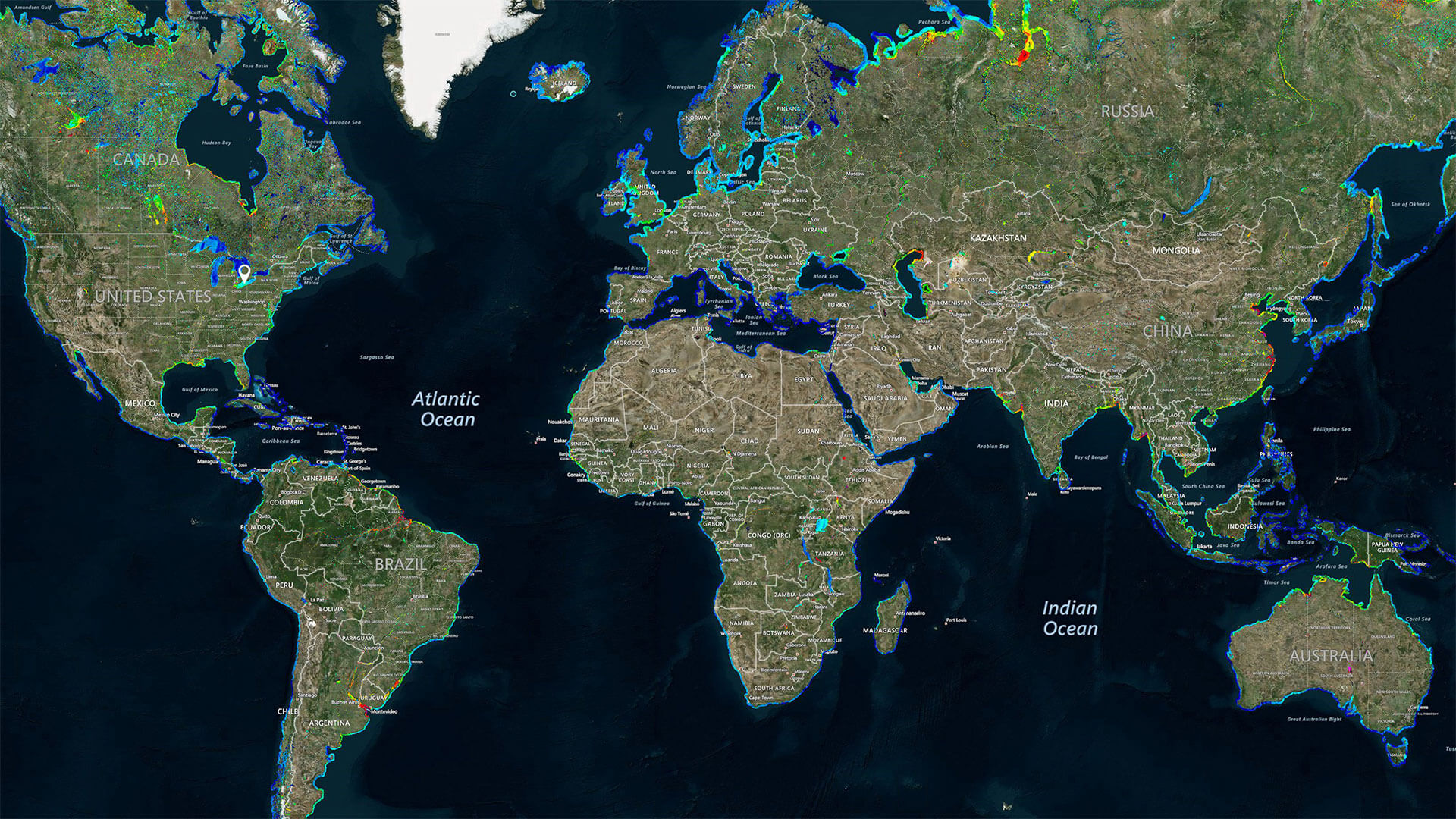
UNESCO-IHP IIWQ World Water Quality Portal
World’s first global water quality portal built to support UNESCO Program
UNESCO, through its International Initiative on Water Quality (IIWQ) has published the […]

Space-O
Space Assisted Water Quality Forecasting Platform for Optimized Decision Making in Water Supply Services
In Europe, as in other parts of the world, freshwater resources are limited and face increasing pressures, […]

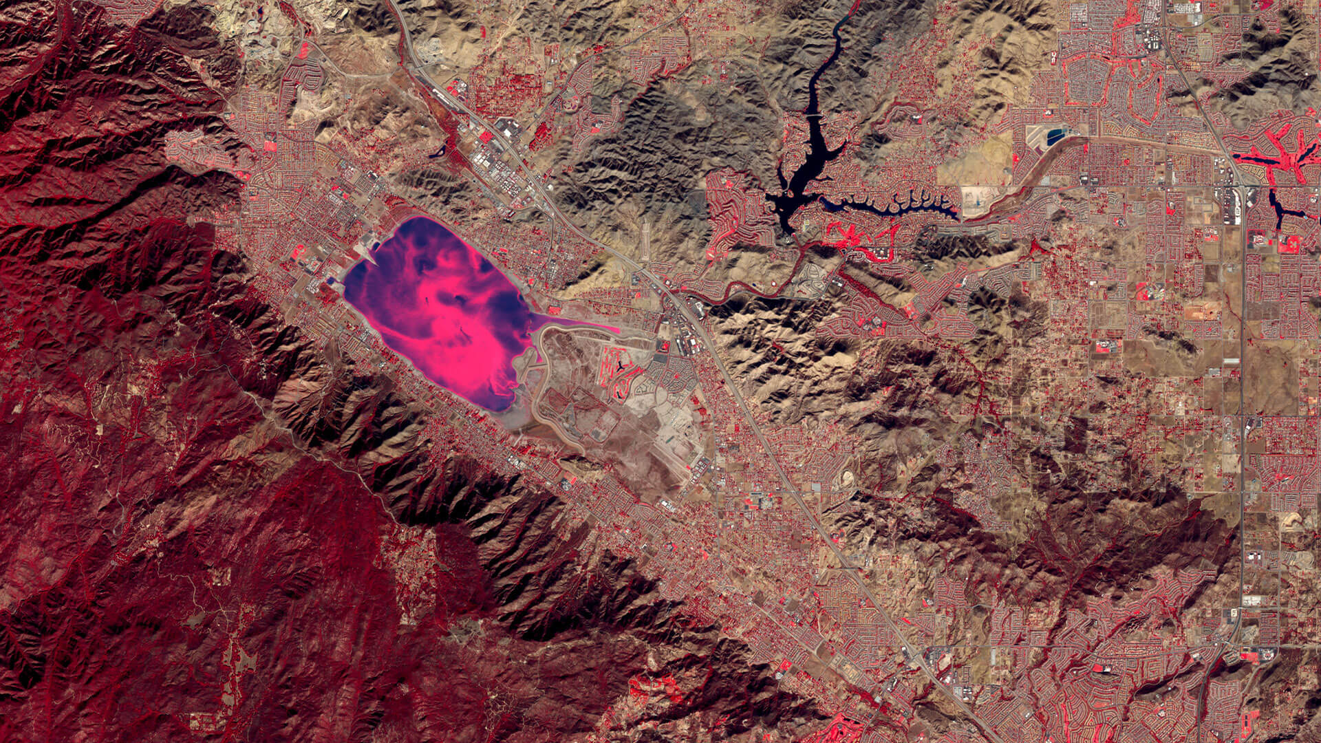
Lake Elsinore & Canyon Lake
Long-term water quality monitoring of two different lakes in California, USA
In July 2015 EOMAP established long-term water quality monitoring services for the American branch of British multi-national consultancy company […]
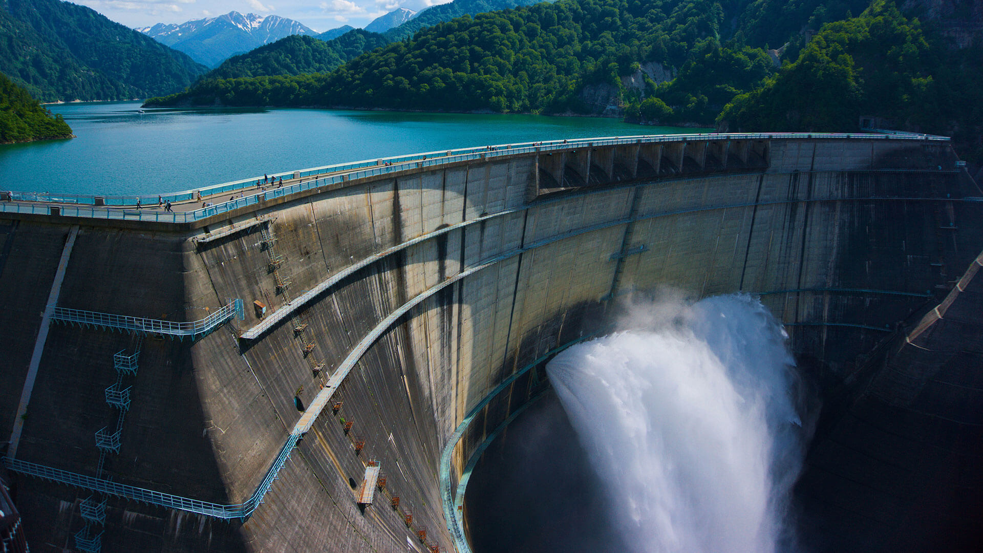
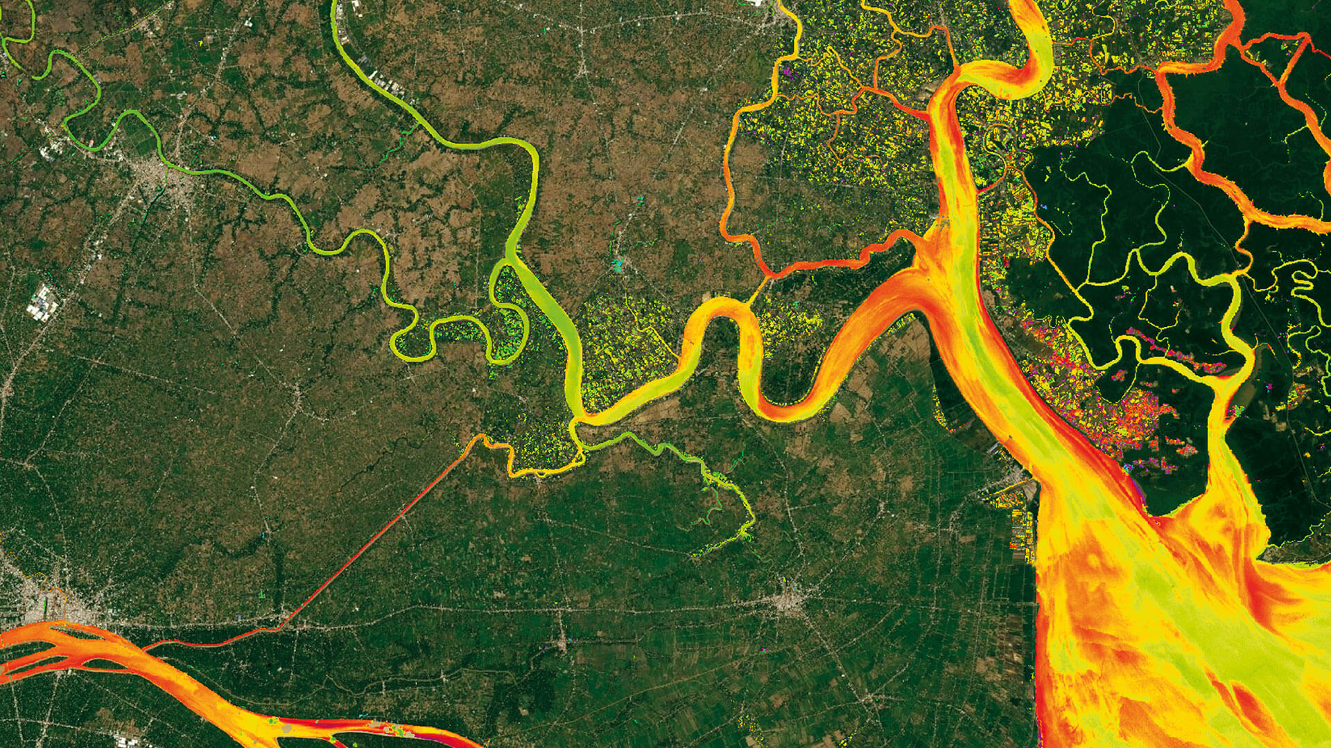
HYPOS
HYPOS integrates multi-source data – for improved hydropower planning and operation
Easy access to and targeted analysis of water quality data such as sediment concentrations and hydrological parameters are […]
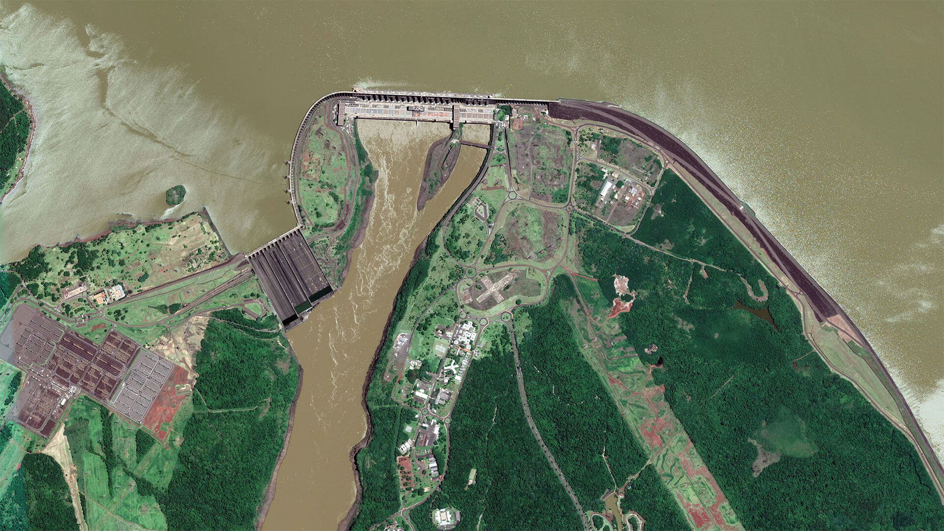
eoLytics Water Quality Processor Licencing for Lactec Brazil
EOMAP issued the first license of its latest, cloud-based processing system for quality assessment of inland and coastal water bodies using satellite data to Brazilian company Lactec.
eoLytics Water […]

Catch-Mekong
Monitoring Sedimentation in the Mekong Delta
The international Catch-Mekong project aims to provide research and technology for the sustainable management of natural resources in the Mekong basin with a special focus […]

Impact factors of oxygen loss on Elbe River
Identifying impact factors for lack of oxygen and biodiversity loss on rivers is challenging. River basins are complex and dynamic ecosystems.
TESA aims to provide new insights into these riverine ecosystems […]
“When (…) combined with in-situ water quality measurements, satellite-derived turbidity data can be used to provide extremely useful data to support a range of different projects including natural sediment transport assessments and monitoring associated with dredging”
Statement
Andrew Symonds in “Dredging Today”
Solutions for Energy & Infrastructure
The following EOMAP services and web apps support project managers, planners and site operators. Please click on the relevant box to find contact persons or demo data for download.
for energy & infrastructure
Sign up to our online solutions eoapp AQUA or eoapp HYPOS to simplify your workflows.