Managing THE
Coastal Zone
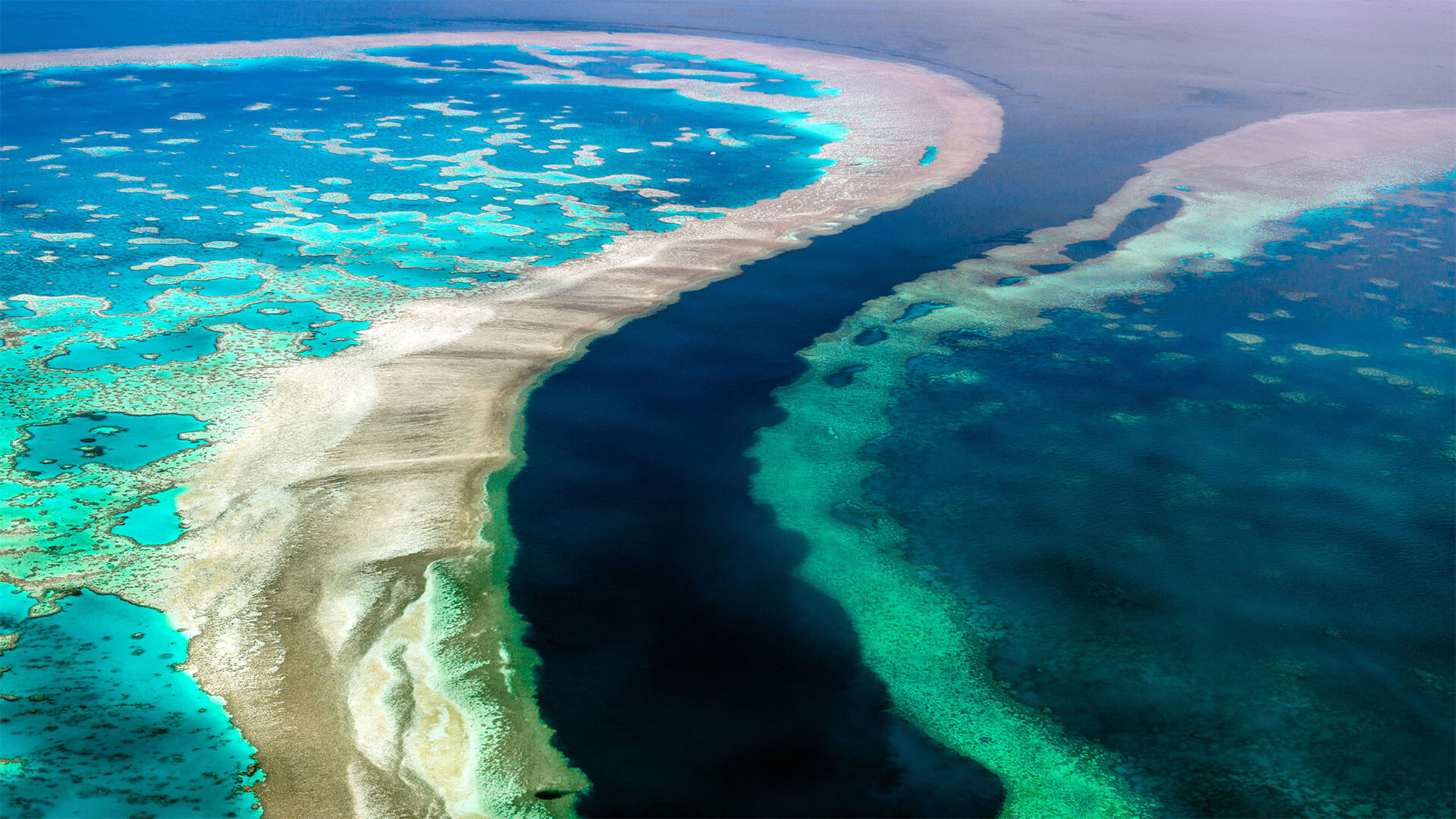
75% of the world’s population lives in coastal areas. We all need clean water and healthy ecosystems, but also a vibrant coastal economy and safety. For sustainably managing coastal zones, you need to understand their morphology, stability, and dynamics. EOMAP provides these insights from space.
Key applications in the coastal zone

Erosion monitoring
Erosion and deposition processes pose a risk to coastal zones. There is a strong need to quantify and identify them.
Erosion Monitoring
Satellite data analytics are the only method available to quantify coastal change, the dynamics of the shoreline, and sediment transport along coastal zones. At EOMAP, we quantify these changes spatially and create time series over decades. This allows for long-term trend analysis, stability classifications, and the prediction of future changes.
These solutions will support shoreline management and climate change adaptation measures in a highly efficient way.

Coastal resilience strategies
Impactful coastal resilience measures call for reliable data. How to have key parameters at hand quickly.
Coastal Resilience
Satellite and airborne image analytics offer strong support for enhancing coastal resilience. This technology helps reveal coastal dynamics and deposition patterns. Thus, it can also pinpoint coastal hazards and vulnerabilities.
EOMAP provides accurate spatio-temporal data on bathymetry, topography, habitats, and water quality. We combine this with third-party data and can connect with local partners for on-site surveys. We utilise the best satellite sources available for frequent, detailed mapping important for coastal resilience.
The data volume can be overwhelming, but our eoapp series turns it into actionable insights. Condensing data into user-friendly dashboards, the web applications support and simplify data-based decision-making.
This knowledge empowers coastal communities to enhance their resilience against climate change impacts and anticipate hazardous coastal events.

Nature based solutions
Nature provides effective solutions to coastal challenges. These ecosystem services need to be carefully assessed.
Nature-based solutions
Nature-based solutions are impactful measures for coastal zone managers. They help face coastal challenges and the impacts of climate change. Coastal habitats, such as seagrass meadows or mangrove forests can mitigate the impacts of strong storm events. Therefore, their ecosystem services are frequently part of coastal resilience and protection strategies. In addition, “blue carbon” habitats serve as natural carbon sinks.
At EOMAP, we quantify biomass and evaluate the health of critical coastal habitats. Building on satellite data analytics, we help our customers observe changes and identify trends. In addition, we can combine these environmental data with time-series to reveal dependencies and predict future habitat developments.
By integrating satellite-based solutions with existing measurement campaigns, we provide a robust foundation for effective green infrastructure and restoration efforts in coastal zones.

Hydrodynamic Modelling
Accurate coastal modelling needs robust underlying data. This is the basis for any construction and management plans.
Hydrodynamic Modelling
EOMAP’s bathymetry and elevation models can provide seamless topo-bathy models and deliver accurate and up-to-date information in these sensitive zones. For providing these coastal models and data, we do not require any on-site activity.
Therefore, we can provide the information faster and at a much lower cost compared with on-site surveys. Coastal engineers and planners can thus count on a robust tool for the planning and hydrodynamic modelling phase of coastal constructions.

Law enforcement
Satellite-based information can simplify the work of authorities. Cost-efficient monitoring and reporting is the result.
Law-enforcement
Regional and national authorities need to comply with legislation, such as the Marine Strategy Framework Directive, the EU Biodiversity Strategy or the European Green Deal.
Earth Observation supports regular monitoring and reporting in a rapid and cost-efficient way using the spatio-temporal information of satellite data. At EOMAP, we observe habitats and monitor parameters which impact them. Moreover, we characterise coastal morphology. After combining and interpreting this data with related coastal information, data and publications, we often engage in workshops with our clients. Together, we develop solutions for smart and efficient reporting routines in line with directives of the European Commission and other legal bodies.
Authorities and organisations on regional, national and international levels not only benefit from our robust data and services. They also value streamlined workflows and efficient reporting routines.
Use cases

REMAP – a new workflow for drone mapping
The R&D project REMAP offers interesting insights and new capabilities into how to use multispectral drone data for efficiently mapping very shallow waters. This project has been finalised together with […]

COASTS – Coastal resilience and blue carbon
COASTS is a European project led by EOMAP. The project team aims to fill important knowledge gaps through the integration of earth observation, advanced modeling, surveying, and digital tools. It […]

Blue carbon – Mangrove mapping in Madagascar
This ecosystem mapping project aims to assess mangrove coverage along the entire coastline of Madagascar. Leveraging satellite data, we establish baseline data on mangrove expansion over time and estimate carbon […]

Seagrass Mapping in Italy
Since 2024, EOMAP has been part of an international consortium dedicated to mapping seagrass meadows along Italy’s entire coastline. This large European habitat mapping project is conducted […]

3D live habitats for the full extent of the Great Barrier Reef
The mapping project, ‘3D live habitats for the full extent of the Great Barrier Reef’, will provide, for the first time, maps of the underwater landscape and predicted types of coral […]

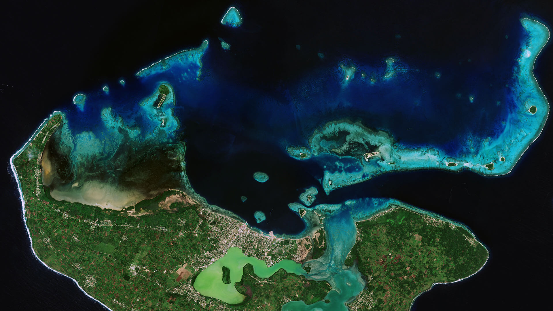
Archipelago of Tonga
Very-High Resolution Satellite-Derived Bathymetry Survey
EOMAP Australia, together with project partner iXsurvey, have been contracted by Land Information New Zealand (LINZ) to map […]

EMODnet
Satellite-Derived Bathymetry for European Coastal Waters
EOMAP provides current high-resolution Satellite-Derived Bathymetry (SDB) for EMODnet Bathymetry, a consortium of 41 European hydrographic offices and oceanographic institutions, research centres and […]

High-Resolution Seafloor Mapping for Environment Agency Abu Dhabi
The Environment Agency Abu Dhabi (EAD) is responsible for facilitating sustainable development, raising environmental awareness and addressing environmental issues. In 2013 EAD began a multi-year programme […]

Mapping Micronesia
Satellite-Derived Bathymetry of Pacific Islands
Many island nations in the Pacific have one thing in common: They lack high resolution and quality survey information on coastal water depth or benthic. Such […]

MarSat – Satellite Services for the Maritime Industry
MarSat is a network of five private companies – EOMAP, Drift & Noise Polar Services GmbH, European Space Imaging GmbH ,
“You could wrap earth 2.5 times with the length of coastal roads at risk of flooding in the U.S.”
National Centres for Coastal Ocean Science – NOAA, United States of America
Solutions for coastal zone management
The below services and web apps are designed for coastal zone managers, researchers, or environmental authorities. Please click on the relevant box to learn more, including contact persons and demo data for download.