Advice4COASTS is a service platform for coastal decision makers. It simplifies the monitoring of coastal environments, supports efficient measurement campaigns and strengthens reporting capacities.
Packed in a smart web app, the new service supports two main applications:
- Bathing Water Quality Monitoring and
- Environmental Monitoring and Reporting
Key data in one place
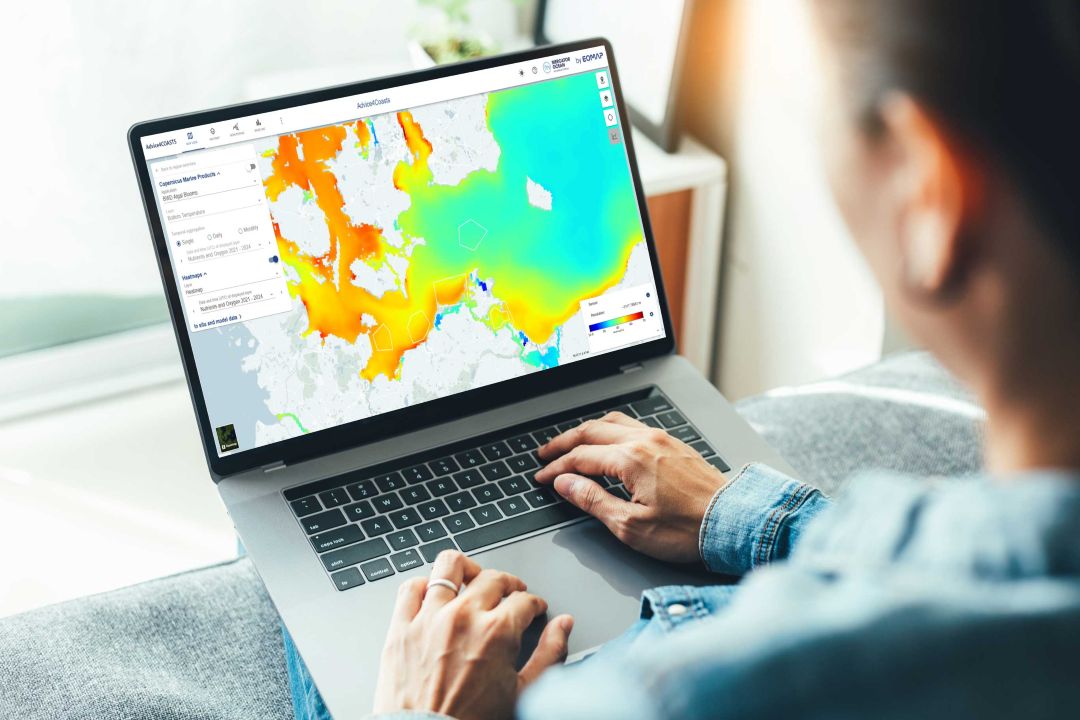
Advice4COASTS leverages data from various Copernicus Service sources such as Copernicus Marine Service (CMEMS), and the European Marine Observation and Data Network (EMODnet). The tool not only aggregates policy-specific key oceanographic and water quality parameters. It also offers automated data integration, analysis, and visualisation.
Coastal decision makers benefit from short- and long-term insights, real-time alerts, and heatmaps or hotspot analysis, visualised on a single dashboard. Users can freely select their areas of interest, ranging from small nearshore bays to large areas of open sea.
This article about a use case at the German Baltic coast highlights heatmaps, one of the key features. It enables to identify ideal conditions for growing seaweed or detect hotspots of eutrophication.
In line with EU directives
The online solution empowers coastal environmental and health authorities to
- perform in-situ campaigns for directive reporting
- identify hot spots of pollution and eutrophication
- detect environmental risks such as algae blooms,
- and comply with key EU directives, including the Marine Strategy Framework Directive (MSFD) and the Bathing Water Directive (BWD).
By combining Copernicus datasets and in situ measurements, the new service will support water quality monitoring and key environmental directives.
Advice4COASTS has been funded by the Copernicus Marine Service National Collaboration Programme 2021-2028.
Let’s connect
Sign up for the eoapp Advice4COASTS here and access free demo regions.
Contact our R&I team for more details!
Images

Short & Sweet
Advice4COASTS is an innovation project leveraging data from Copernicus Services. Providing key satellite-based data for coastal authorities on smart dashboards, it enables users to monitor coastal waters of all sizes more efficiently than before.
Place & Time
Baltic Sea, worldwide, 2025 – 2026
Clients & Partners
Mercator Ocean International, Landesamt für Umwelt Mecklenburg-Vorpommern
Related Use Cases
SmartCoast – Mangrove mapping in Australia
Water monitoring along the Zambezi
Kelp monitoring in Los Angeles ports
Snowpower
REMAP – a new workflow for drone mapping
Impact factors of oxygen loss on Elbe River
COASTS – Coastal resilience and blue carbon
Blue carbon – Mangrove mapping in Madagascar
Seagrass Mapping in Italy
4S project – SDB mapping worldwide
