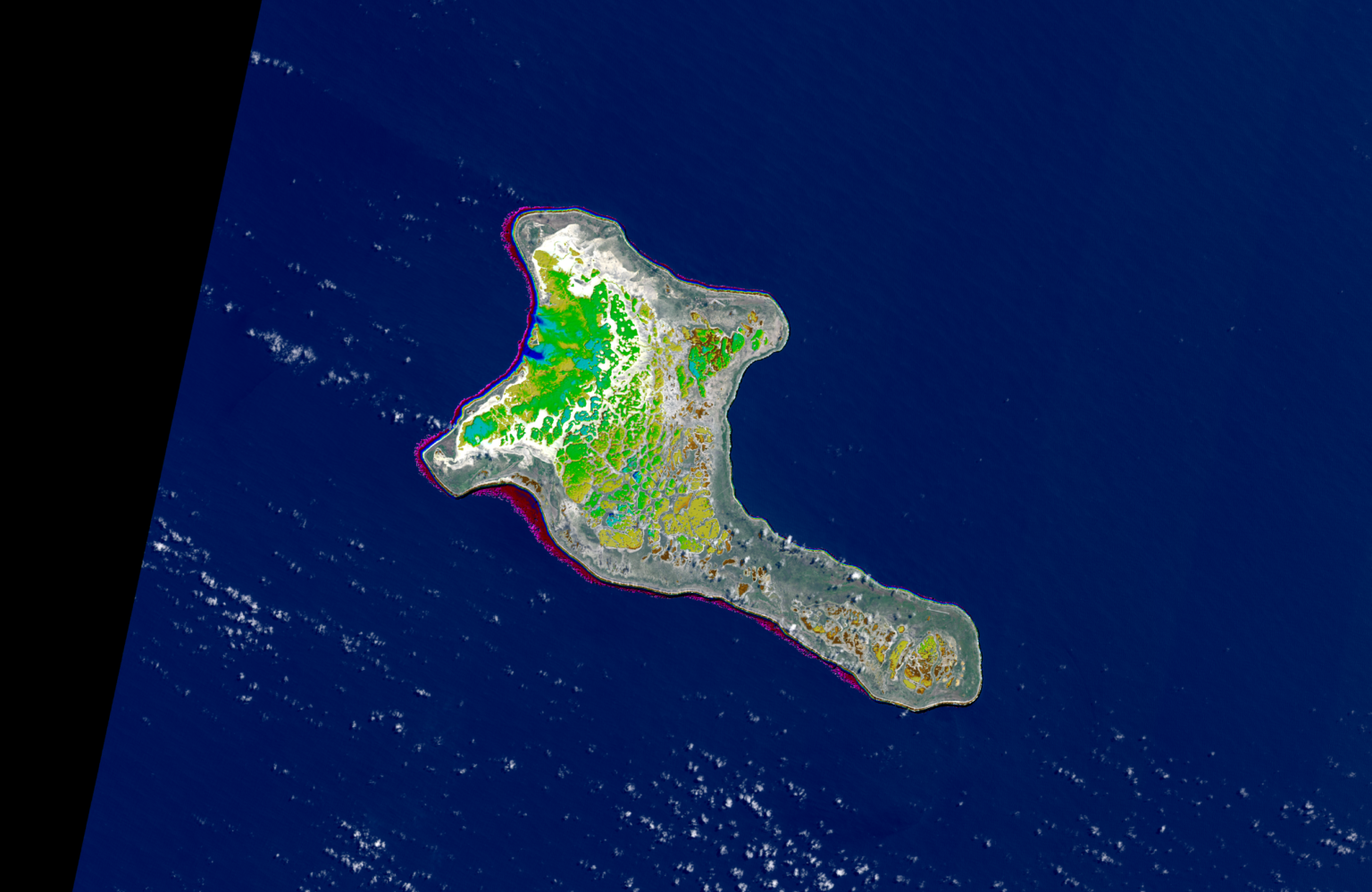
Satellite-Derived Bathymetry of Pacific Islands
Many island nations in the Pacific have one thing in common: They lack high resolution and quality survey information on coastal water depth or benthic. Such information gaps are critical when it comes to navigation and managing these coastal and shallow waters. In 2021, EOMAP was awarded several contracts – among others by The Nippon Foundation-GEBCO Seabed 2030 Project – to map the seafloor of several Pacific states, including Kiribati, the Marshall and Solomon islands.
By using multiple multispectral satellite imagery and applying a physics-based Satellite-Derived Bathymetry approach we created gap free and dense bathymetric grids for all the sites. Our Satellite-Lidar Bathymetry (SLB) database building on the active green Lidar point cloud analysis from IceSat-2 Atlas sensor allowed us to evaluate the vertical uncertainties of the grids. Overall, we provided approximately 15 thousand square kilometres of shallow waters which had never been mapped or surveyed before. Furthermore, we achieved a thematic ecological classification of seafloor habitat for some of the nations and provided reflectance products creating an inventory of critical habitat, such as corals and seagrass.
Images
Related Use Cases
SmartCoast – Mangrove mapping in Australia
Advice4COASTS
Kelp monitoring in Los Angeles ports
REMAP – a new workflow for drone mapping
Impact factors of oxygen loss on Elbe River
COASTS – Coastal resilience and blue carbon
Blue carbon – Mangrove mapping in Madagascar
Seagrass Mapping in Italy
4S project – SDB mapping worldwide
3D live habitats for the full extent of the Great Barrier Reef
