Satellite surveying tool helps to improve ship navigation
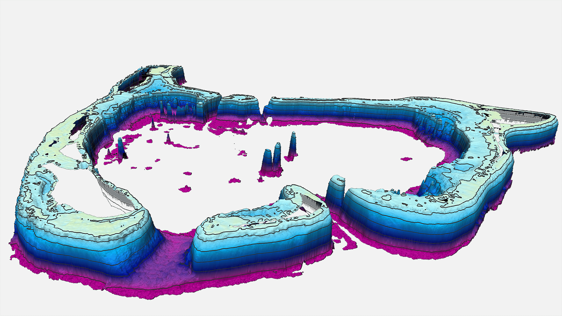
EOMAP has been awarded a contract for providing Satellite-Derived Bathymetry (SDB) for seven atolls of Tuvalu. The project was awarded through a competitive bid contract issued and overseen by the UK Hydrographic Office (UKHO).The project is being completed on behalf of the Tuvalu Government. The funding is provided under the UK Government’s Commonwealth Marine Economies Programme, which aims at supporting sustainable growth of Commonwealth Small Island Developing States (SIDS) within the Caribbean and Pacific Ocean Regions. As a SDB framework provider for the UKHO, EOMAP won a competitive tender to provide SDB data of Southern Antigua in 2015. The shallow water data was included in the ADMIRALTY Navigational Chart of the area, and the grids are valuable datasets for coastal engineering companies, coastal zone managers and environmental impact studies.
Related Use Cases
SmartCoast – Mangrove mapping in Australia
Advice4COASTS
Kelp monitoring in Los Angeles ports
REMAP – a new workflow for drone mapping
Impact factors of oxygen loss on Elbe River
COASTS – Coastal resilience and blue carbon
Blue carbon – Mangrove mapping in Madagascar
Seagrass Mapping in Italy
4S project – SDB mapping worldwide
3D live habitats for the full extent of the Great Barrier Reef
