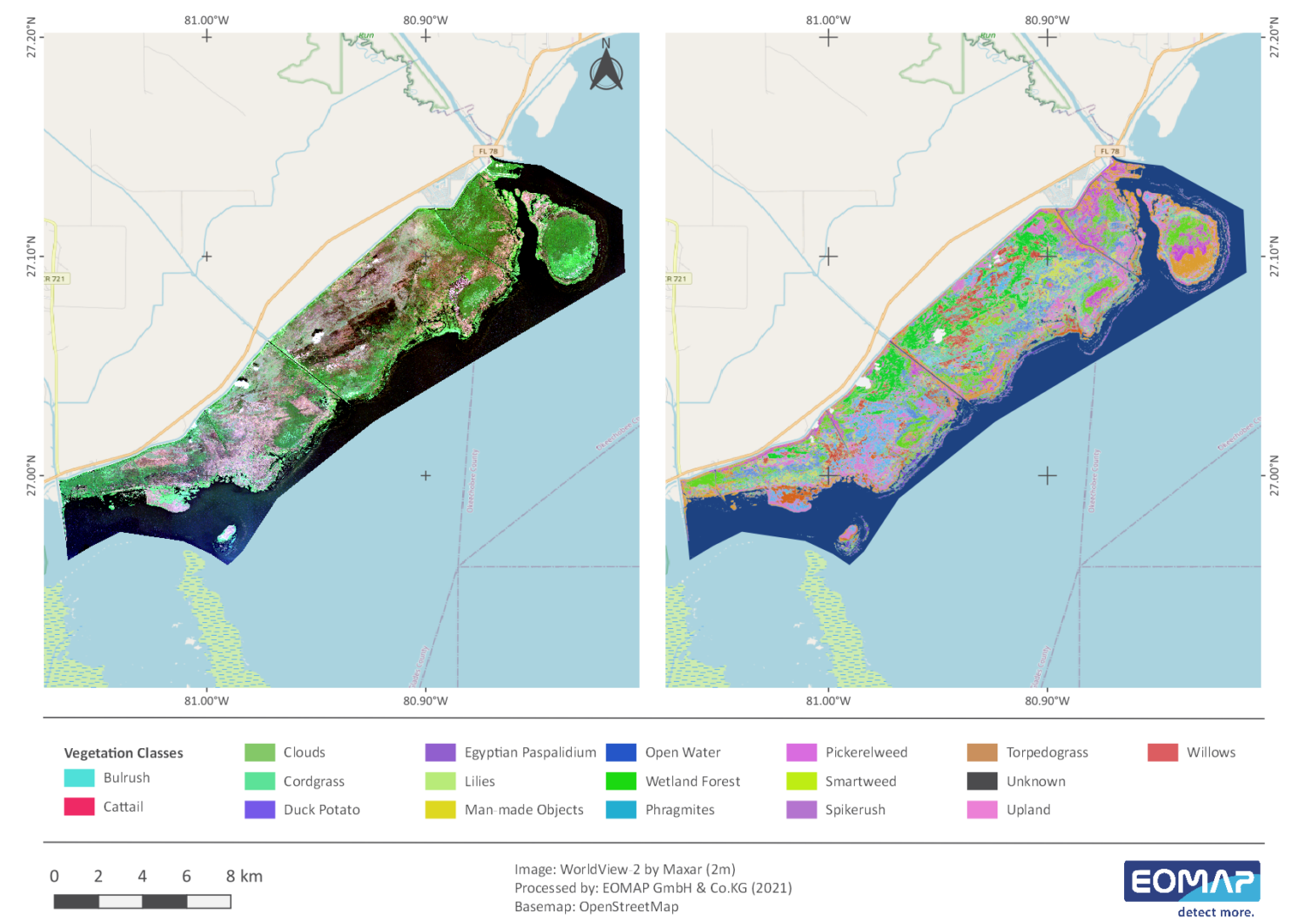
In 2017, together with EOMAP, Navico, a leading supplier of digital navigation for the maritime market, launched a new semi-automated wetland and coastal habitat mapping product. It is part of the BioBase mapping platform. Using EcoSat we can build on the unique reflectance properties of vegetation and sea floors to derive distinct polygon objects with spatial properties, such as area and perimeter, from very-high resolution satellite imagery. These mapping results are then being displayed and can also be edited on the EcoSat platform.
Since the project start, various lakes in Florida have been mapped, including Lake Istokpoga, Lake East Tohopekaliga or the northwestern marsh of Lake Okeechobee. For these, EOMAP delivers (very-)high resolution satellite data from WorldView, GeoEye, Pleiades or Sentinel-2 and carries out a semi-automated vegetation classification on behalf of the Florida Fish and Wildlife Conservation Commission (FWC). The output of this classification is based on a few ground control points for classifier training (supervised random forest). It covers almost 20 distinct species of wetland macrophytes. As the classifier is developing, fewer training points are necessary each year. Therefore, the mapping of vast and inaccessible areas can be performed with very little sampling effort.
Images
Related Use Cases
SmartCoast – Mangrove mapping in Australia
Advice4COASTS
Kelp monitoring in Los Angeles ports
Impact factors of oxygen loss on Elbe River
COASTS – Coastal resilience and blue carbon
Blue carbon – Mangrove mapping in Madagascar
Seagrass Mapping in Italy
Extensive High-Resolution Baltic Sea Habitat Mapping
High-Resolution Seafloor Mapping for Environment Agency Abu Dhabi
Mapping Micronesia
