08 / 2023
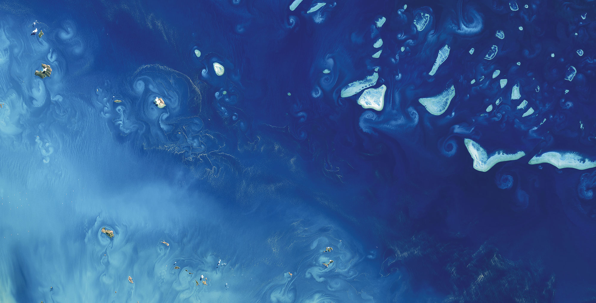
Ashmore and Cartier – Mapping Australian Marine Parks
SDB and seafloor data go public Ashmore and Cartier Island Marine Park maps of Satellite-Derived [...]
08 / 2023
Drone-derived mapping in Prerow
In August 2023, Fugro and EOMAP successfully conducted a joint drone survey mission in the [...]
06 / 2023
SDB-Online Revamp
The new interface of SDB-Online ... will be live as of 21st June, the World [...]
06 / 2022
Belize bathymetry delivered to UKHO
Belizean shallow waters from Space - The largest survey of its kind in the Caribbean [...]
09 / 2021
EOMAP is new partner to the Seabed 2030 project – press release
Shallow waters represent the most crucial aquatic zones on Earth. They are particularly difficult [...]

08 / 2020
World Hydrography Day 2020 – SDB Day Webinar
Satellite Derived Bathymetry nowadays contributes to safety of navigation in manyfold coastal regions of Indonesia. [...]

04 / 2019
What’s behind the ground-breaking 3D habitat map of the Great Barrier Reef?
International aquatic remote sensing company EOMAP will showcase its unique contribution to the world-first 3D [...]

11 / 2018
How satellite data support maritime boundary disputes
Coastline delineation and coastline dynamics When it comes to maritime boundary disputes between two States [...]

10 / 2018
Optimizing hydrographic survey campaigns with Satellite-Derived Bathymetry
Seefeld, October 2018, EOMAP, together with iXblue, have mapped Satellite-Derived Bathymetry (SDB) for the Tongan [...]
09 / 2018
Satellite Data Services for the Maritime Industry: Potential Value unlocked
Hamburg, September 2018 Following the success of last year’s workshop, MarSat, a corporate network of [...]

0
international awards
EOMAP – A FUGRO COMPANY
EOMAP OFFICES
LINKS
Copyright 2026 EOMAP GmbH & Co. KG • Imprint • Privacy Policy • Cookie settings