4S stands for “Satellite Seafloor Software Suite”, an innovation project co-funded by EU Horizon Europe. Under the lead of EOMAP, eight renowned partners cooperated from 2019 to 2023. The 4S project sought to bring a higher level of automation and standardisation to shallow water mapping.
Understanding shallow waters
A deep understanding of the bathymetry and morphology of shallow waters is crucial for marine and coastal management. This knowledge is essential for activities such as coastal engineering and planning. Digital data on seabed characteristics not only greatly aids operations such as dredging, sand reclamation and navigation. Moreover, it supports targeted protection of critical habitats in shallow waters and thus helps strengthen biodiversity, carbon storage and coastal protection.
Digital data needed
Collecting data on shallow water morphology and habitats is currently linked to cost-intensive boat or airborne surveys, diving campaigns or cameras. These methods are not only risky, they are also limited by budget constraints and cannot provide continuous monitoring. To overcome this dilemma, the 4S project team strived to develop a cloud-based software solution building on satellite data. This online solution aimed at empowering its users to map and monitor seafloor habitats, morphology and water depth from the comfort of their desks.
Harnessing Copernicus data
The 4S team harnessed Copernicus satellite data and other Earth Observation information and combined them with user data. These were analysed in a state-of-the art workflow for aquatic remote sensing and service components, before being processed and stored in a cloud environment. Apart from a global map for SDB application, the major outcome is the online solution SDB-Online.
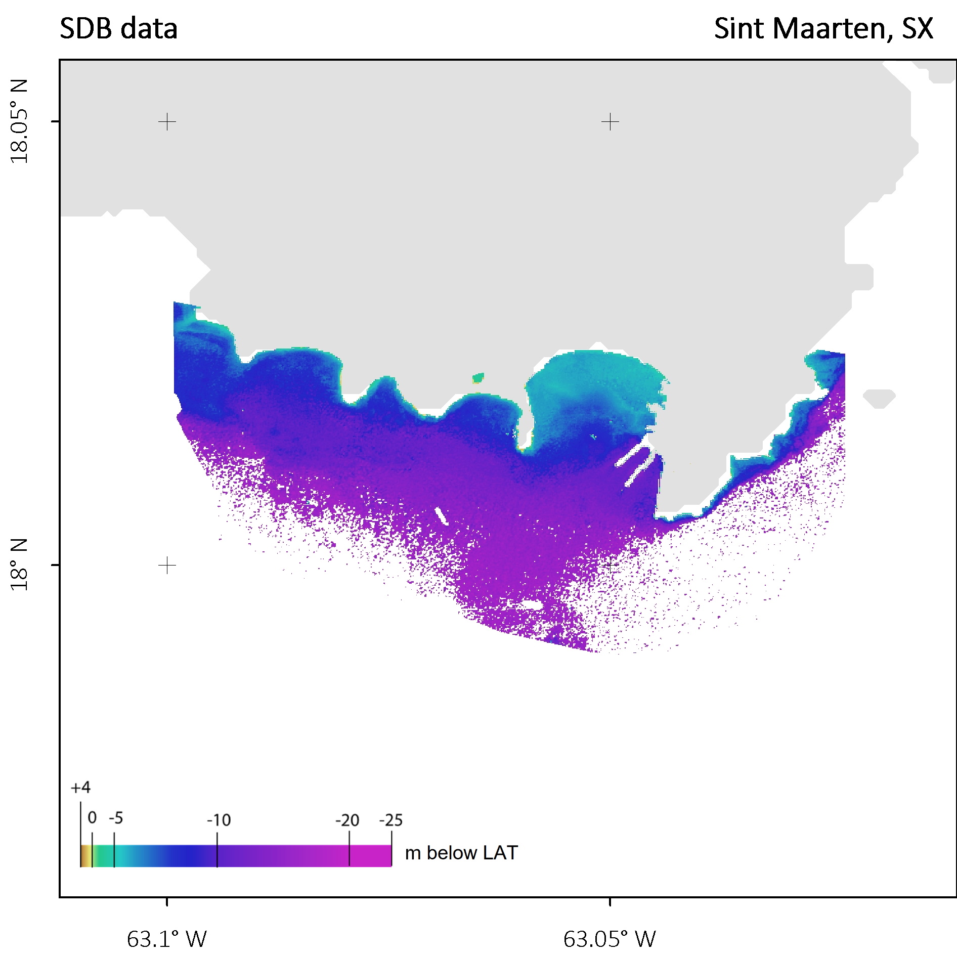
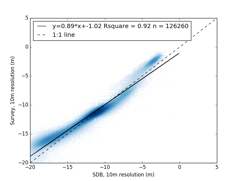
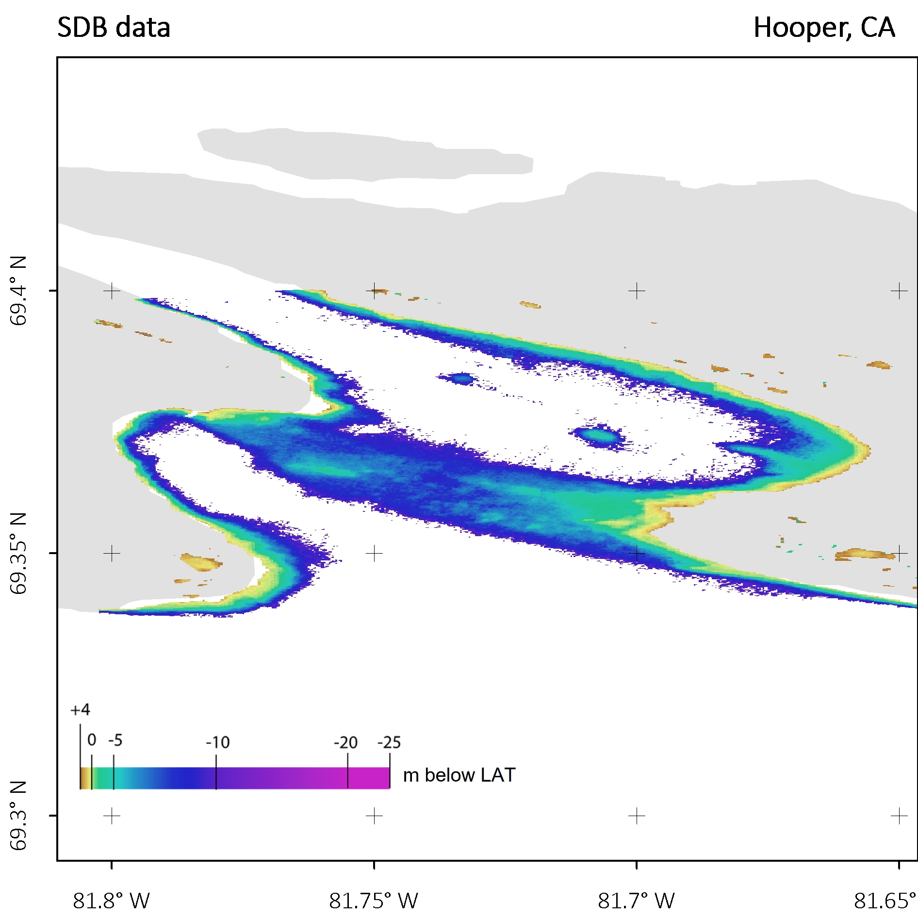
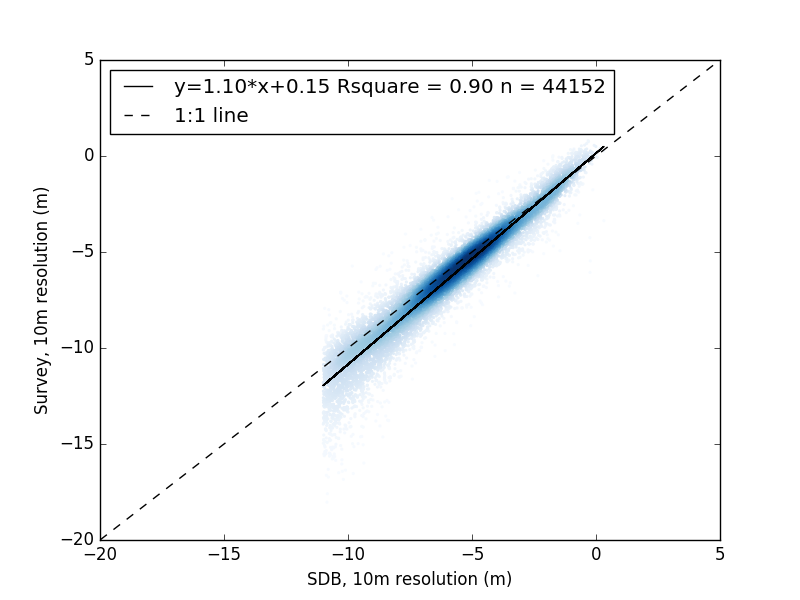
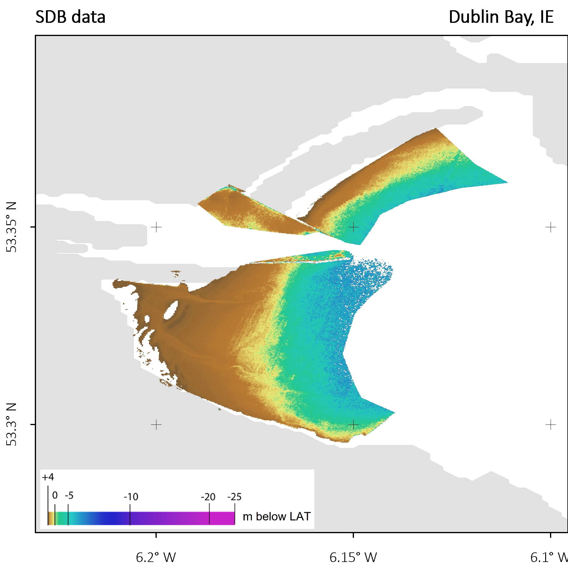
Validating across the world
Throughout the 4S project, the partners have optimised usability and validity of the software suite in +15 use cases. These range from the high latitudes of Canada to the turbid waters in Dublin Bay to the crystal-clear Caribbean. (See validation plots at the bottom.)

SDB of Hooper Island, Canada
More on 4S
Learn more about the project in the CORDIS article “Powerful tool surveys water depth in shallow waters from space”.
Read about detailed validation analysis in the peer-reviewed ‘International Hydrographic Review’.
Watch the video with interviews of all 4S project partners below.
Contact
Reach out to our coastal team for more details on the 4S project.
Try the web app SDB-Online here.
Images


Quick information
Within 4S, a cloud-based software solution was developed. It empowers users to map and monitor seafloor habitats, morphology and water depth from the comfort of their desks. The project partners optimised usability and validity of the software suite in +15 use cases. Together, they helped develop the web app SDB-Online.
Place & Time
Worldwide, 2019 – 2023
Partners
Fugro Germany Marine; Instituto Hidrografico, Portugal; National Research Council (CNR-ISMAR), Italy; Hellenic Centre for Marine Research (HCMR), Greece; Länsstyrelsen Västerbotton, Sweden; Quality Positioning Services (QPS), The Netherlands; Smith Warner International (SMI), Jamaica.
Related Use Cases
SmartCoast – Mangrove mapping in Australia
Water monitoring along the Zambezi
Advice4COASTS
Snowpower
REMAP – a new workflow for drone mapping
Impact factors of oxygen loss on Elbe River
COASTS – Coastal resilience and blue carbon
Blue carbon – Mangrove mapping in Madagascar
Seagrass Mapping in Italy
3D live habitats for the full extent of the Great Barrier Reef
