Satellite-Derived Bathymetry for European Coastal Waters
EOMAP provides current high-resolution Satellite-Derived Bathymetry (SDB) for EMODnet Bathymetry, a consortium of 41 European hydrographic offices and oceanographic institutions, research centres and commercial data providers.
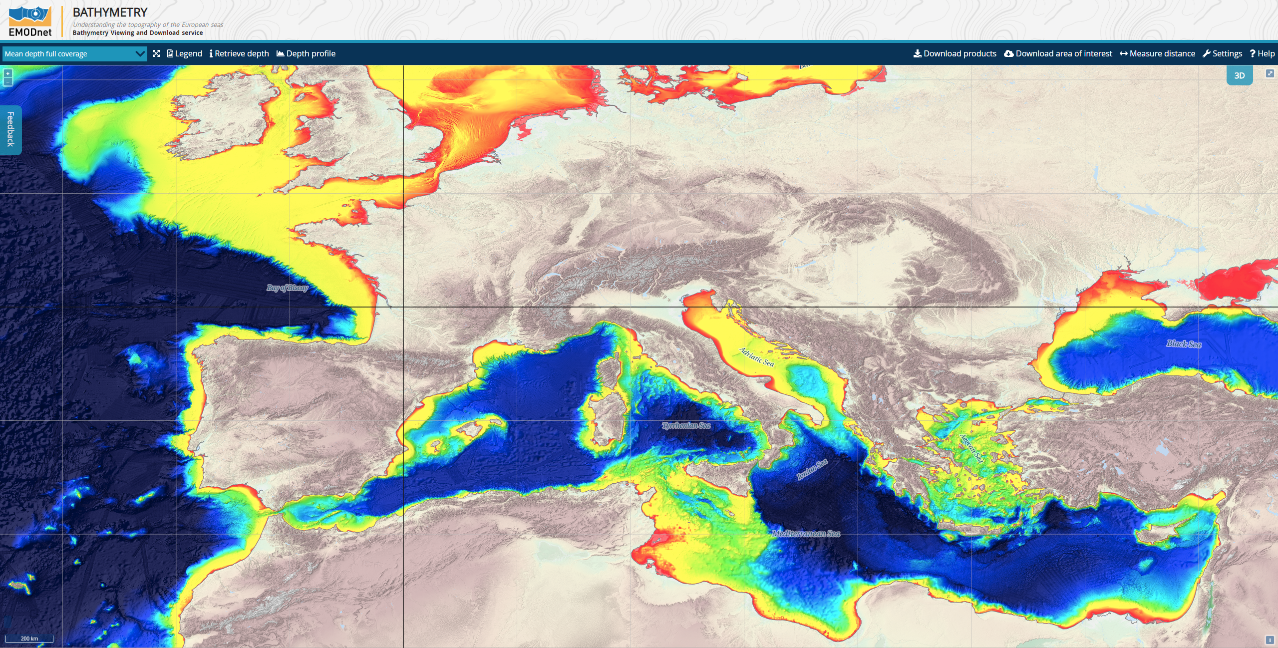
Up-to-date, high-resolution bathymetric data is increasingly important for a large number of applications, such as hydrodynamic modelling, sediment transport, cable routing, coastal planning, resource exploration and defence purposes. The EMODnet Bathymetry portal offers access to a high-resolution sampled grid of bathymetric survey data and metadata provided by the network partners. These data are being harmonised to create a seamless European bathymetric grid.
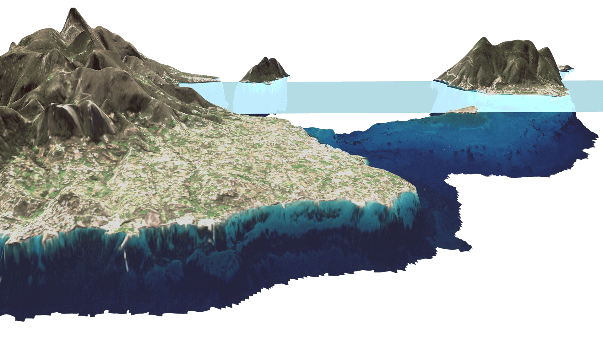
EOMAP contributes bathymetry for shallow waters that are poorly, if at all, covered by conventional survey data. Previously these areas were interpolated, with potentially high uncertainties. Now, by using satellite-derived bathymetry information, the digital terrain model is constrained by physically derived data in these areas, providing much higher detail.
EMODnet Bathymetry applies SeaDataNet standards and services for discovery and access to its bathymetric data resources. SeaDataNet is the leading infrastructure in Europe for marine and ocean data management.
Images
Quick information
Related Use Cases
SmartCoast – Mangrove mapping in Australia
Water monitoring along the Zambezi
REMAP – a new workflow for drone mapping
COASTS – Coastal resilience and blue carbon
Blue carbon – Mangrove mapping in Madagascar
Seagrass Mapping in Italy
4S project – SDB mapping worldwide
3D live habitats for the full extent of the Great Barrier Reef
Archipelago of Tonga
Water Quality for Lactec Brazil
