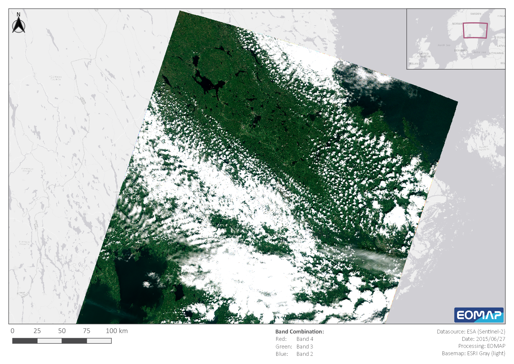
In 2015, the European Space Agency (ESA) launched its own high resolution earth observation satellite system from the Sentinel program, Sentinel-2. Since then, it has provided us with enormous amounts of fantastic data, all for free, accessible to everybody. For us here at EOMAP, this started a new era, giving us access to the best combination of spatial and temporal resolution that we ever had. Consequently, Sentinel-2 is specifically precious to us and we want to celebrate its half-decade birthday with some of our favorite images from all around the globe. See for yourself!
-
 ⧉
⧉ -
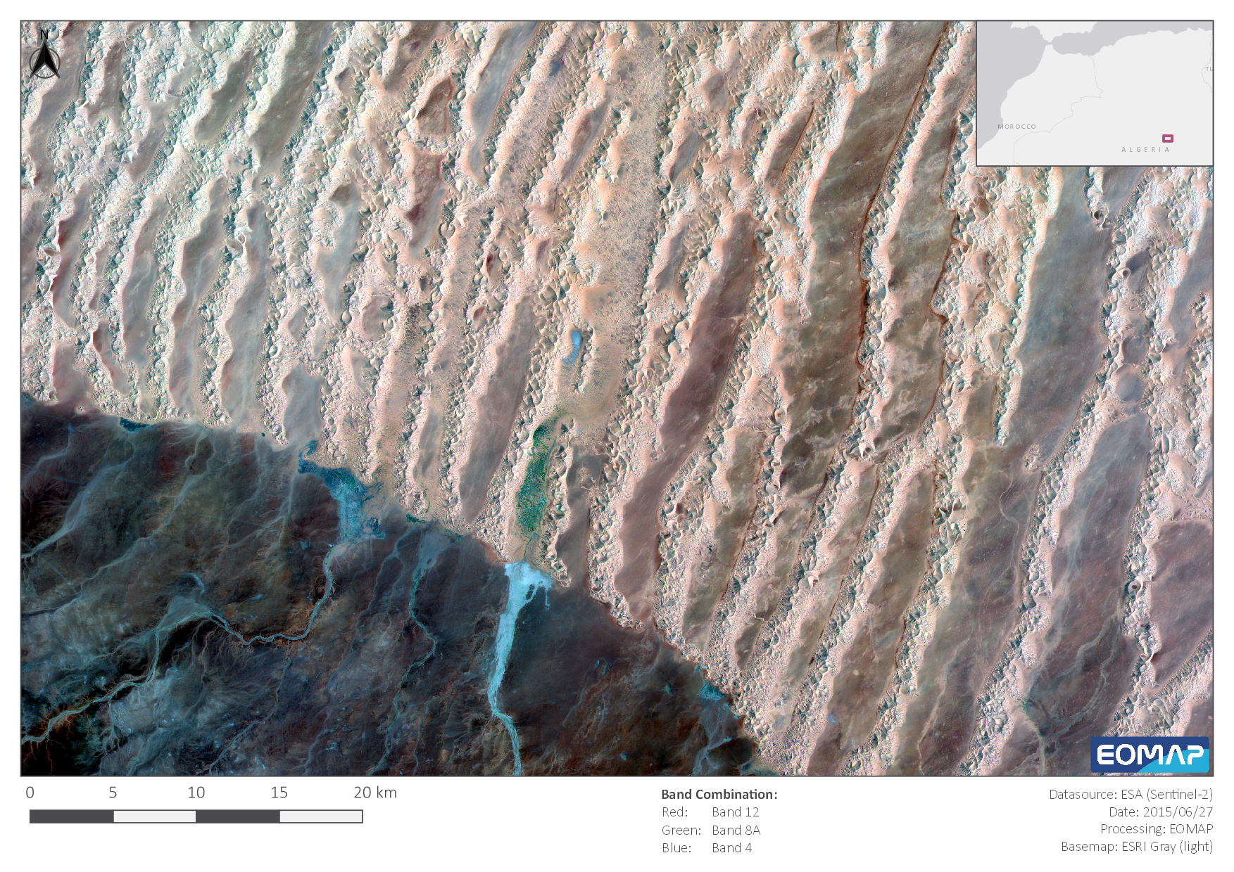
The Sahara Desert in June 2015, Sentinel-2 satellite image processed by EOMAP
⧉ -
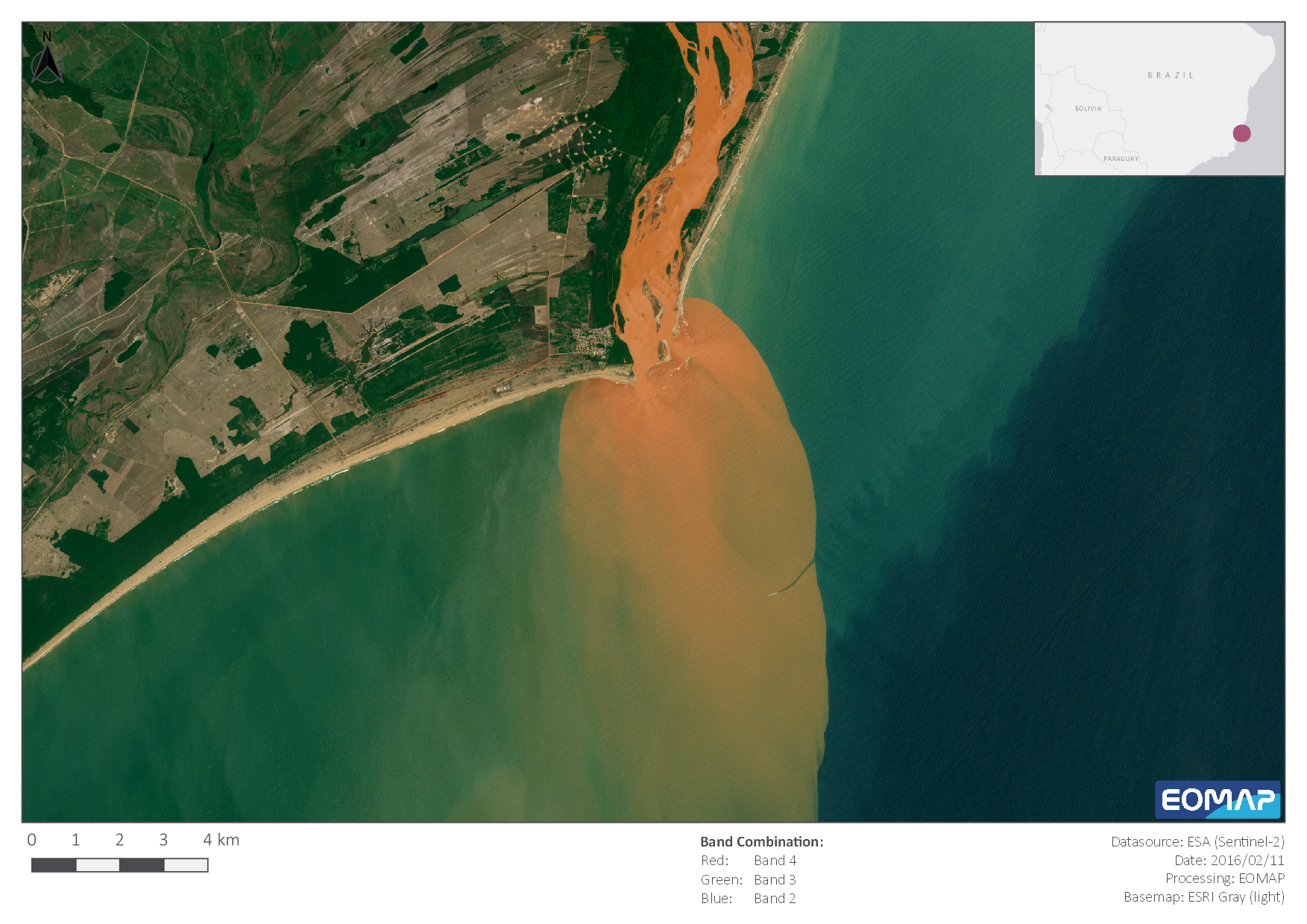
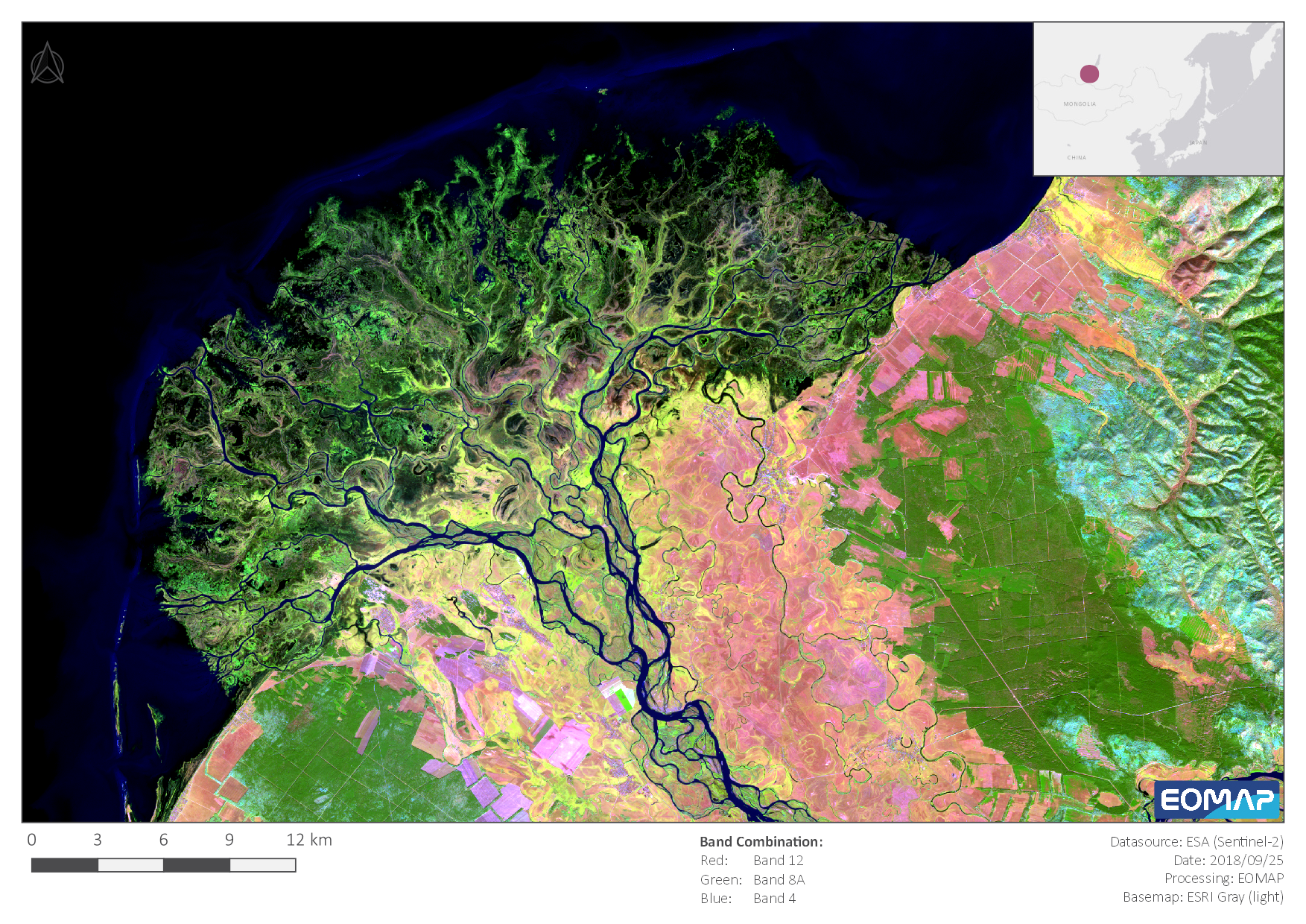
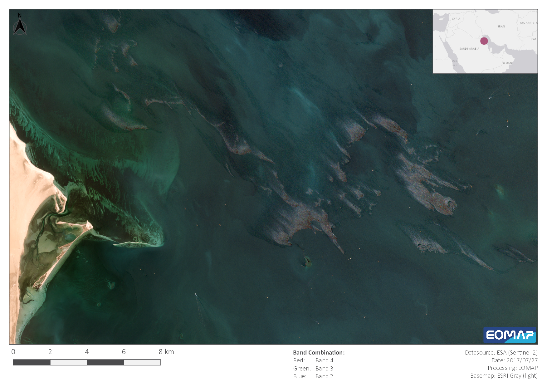
The inflow of Rio Doce into the Atlantic Ocean, February 2016 - Sentinel-2 satellite image processed by EOMAP
⧉ -
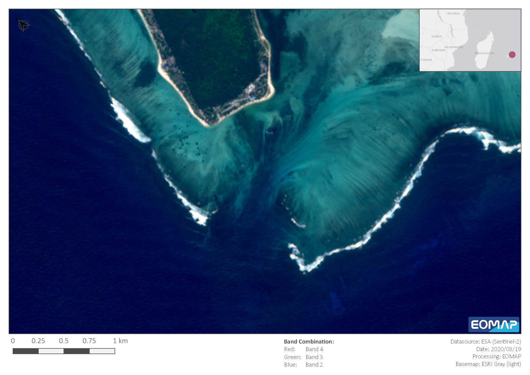
The eastern coast of Mauritius in March 2020 - Sentinel-2 satellite image processed by EOMAP
⧉ -

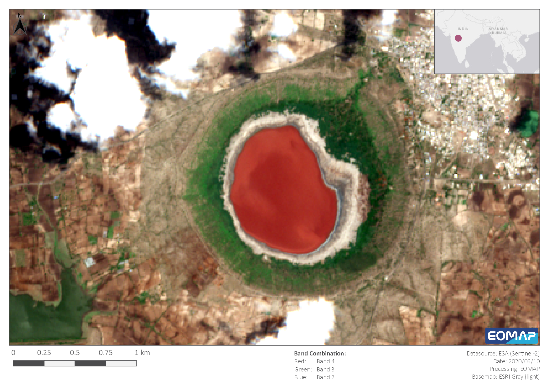
Lake Taal, Philippines, March 2019 - Sentinel-2 satellite image processed by EOMAP
⧉ -
 ⧉
⧉ -
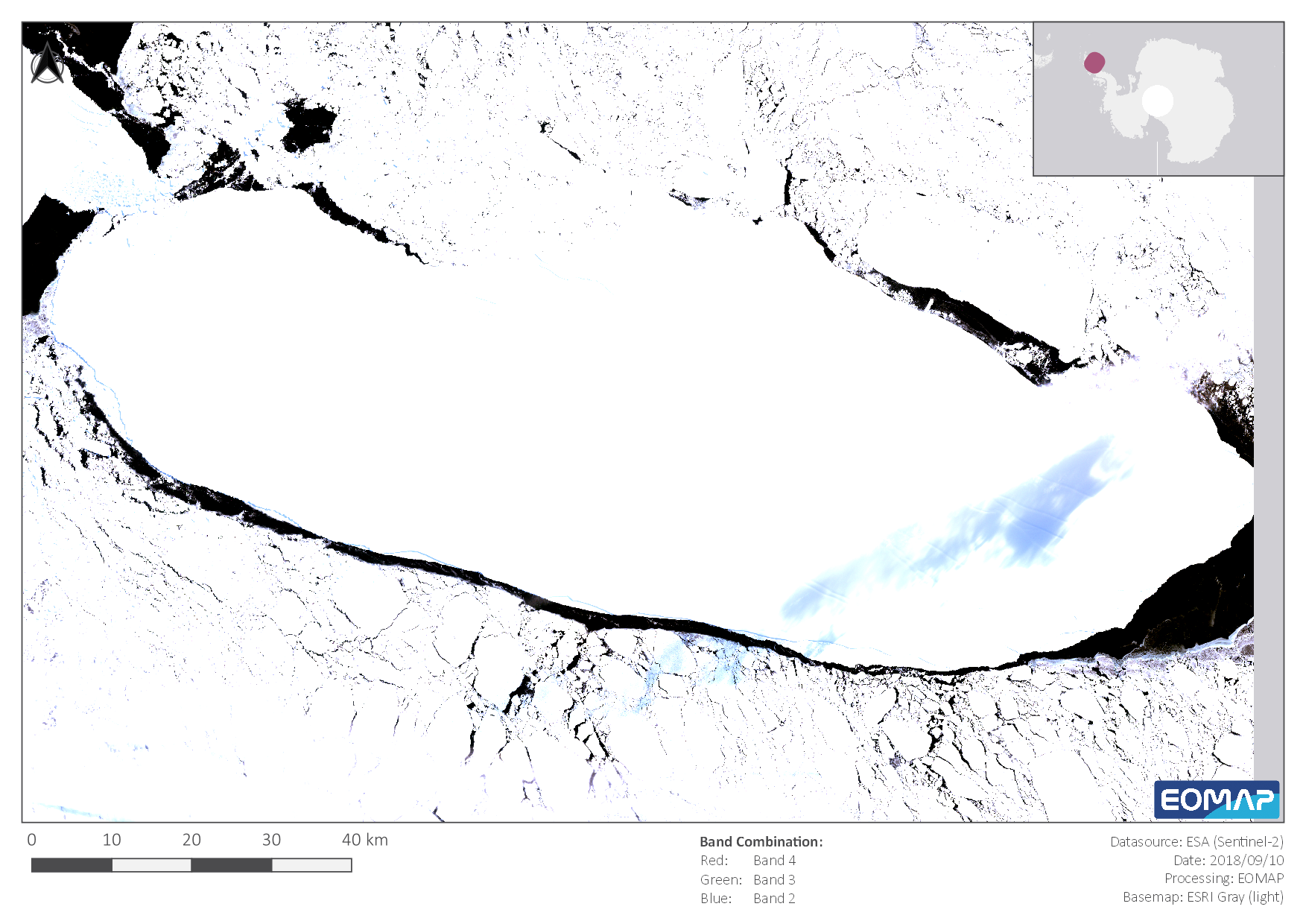
Lake Baikal in September 2018 - Sentinel-2 satellite image processed by EOMAP
⧉ -
 ⧉
⧉ -
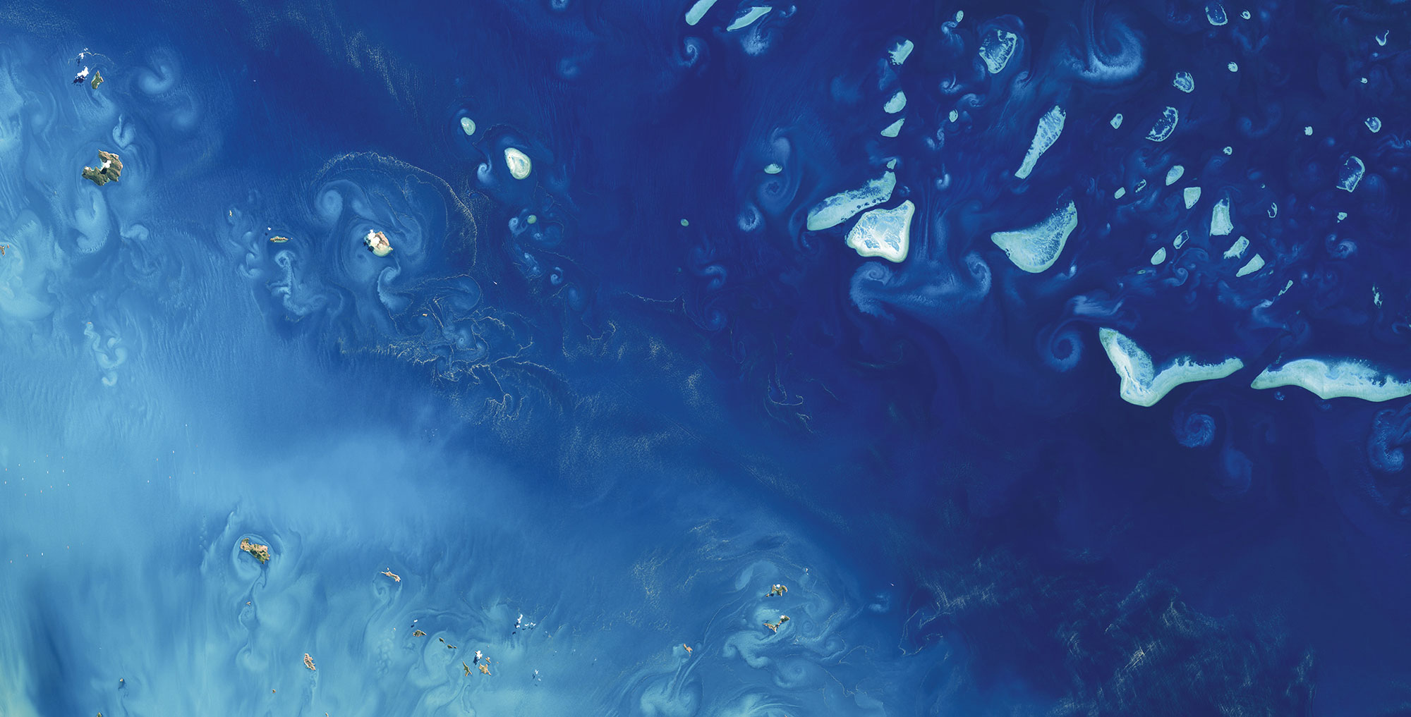
A zoom into an algal bloom in the Baltic Sea in July 2019. These natural phenomena tend to increase with global warming. - Sentinel-2 satellite image processed by EOMAP
⧉ -
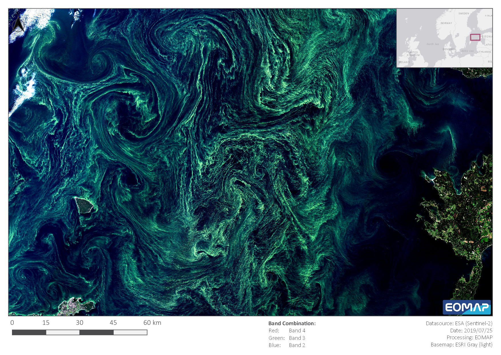
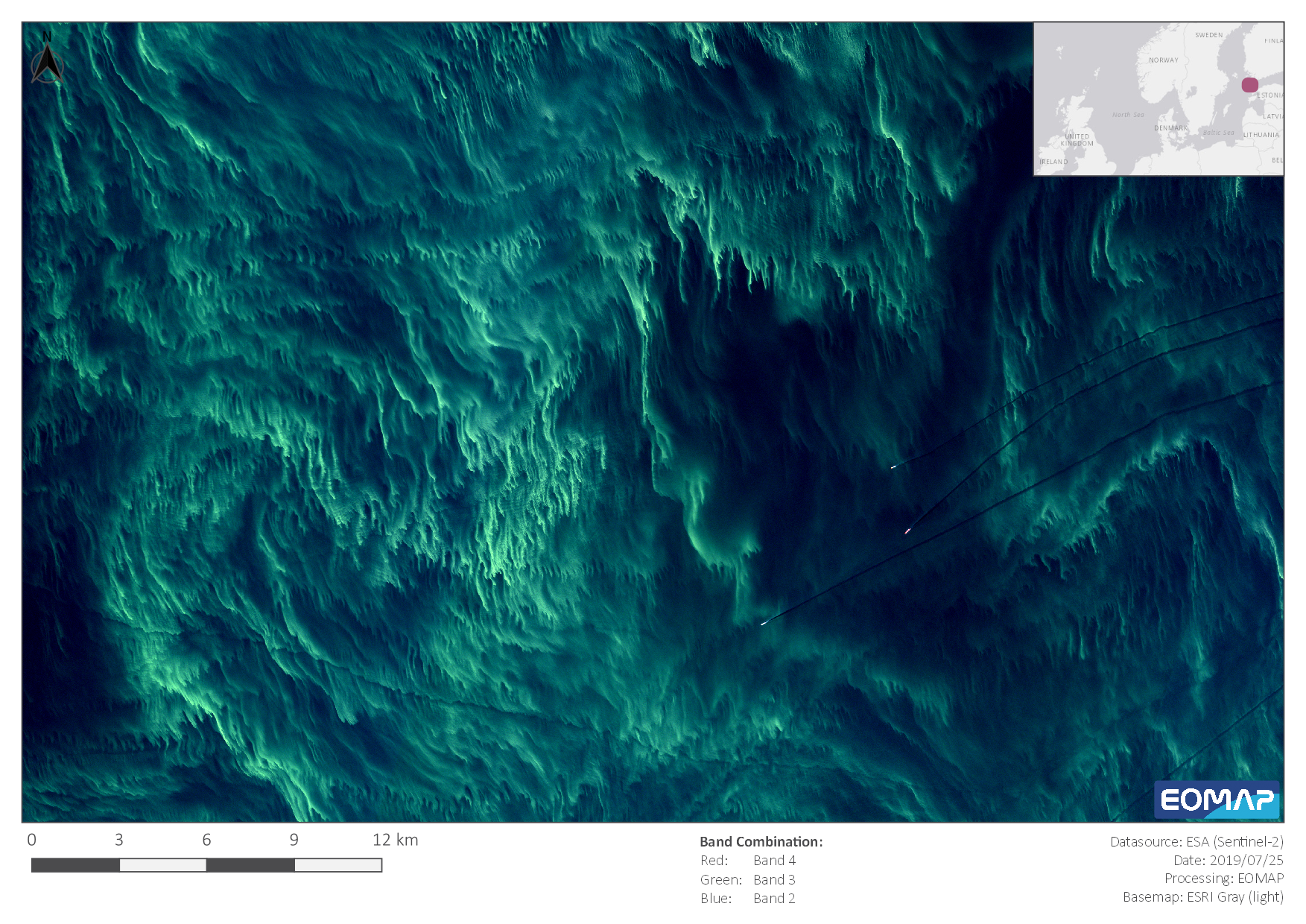
Algal Bloom in the Baltic Sea in July 2019. These natural phenomena tend to increase with global warming. - Sentinel-2 satellite image processed by EOMAP
⧉ -
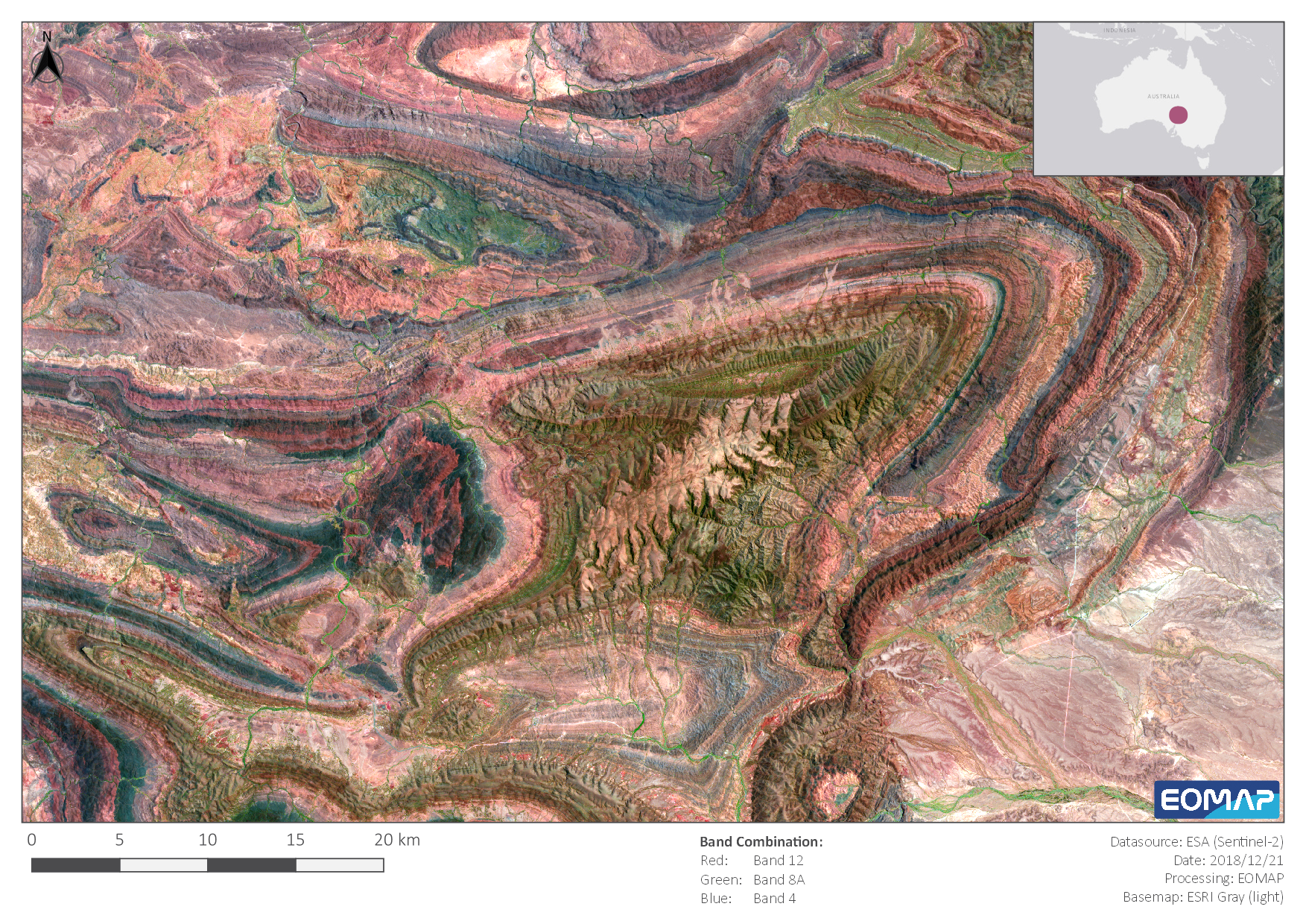
Colourful geology in Southern Australia, captured in December 2018- A Sentinel-2 satellite image processed by EOMAP
⧉ -
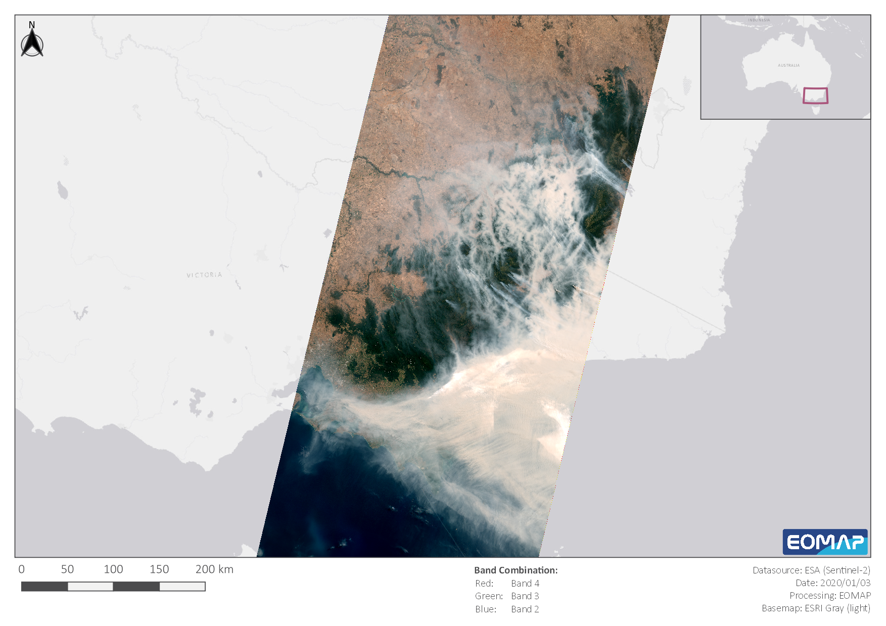
Fire in Southern Australia, captured in January 2020 - A Sentinel-2 satellite image processed by EOMAP
⧉ -
 ⧉
⧉
Latest EOMAP News

Reuters bases Mekong article on EOMAP data

UKHO’s highest-ranked Satellite-Derived Bathymetry provider in 2015

Mapping the ‘unmappable’ Great Barrier Reef

Dredge plume monitoring using satellite-based turbidity mapping

Pioneering seagrass mapping at the Italian coastline in 2006

Mapping Ningaloo Reef 2009: A Breakthrough in Hyperspectral Marine Habitat Analysis
Related Posts

03 / 2026
New BD & Sales Manager for the Americas

12 / 2025
A short recap of 2025

05 / 2025
Planet contract: Supporting Germany’s water monitoring

03 / 2025
German Innovation Prize 2025 – EOMAP listed among top 3

03 / 2025
Deutscher Innovationspreis 2025 – EOMAP unter den top 3

02 / 2025
Fugro acquires EOMAP

02 / 2025
Fugro erwirbt EOMAP

12 / 2024
A short recap of 2024

12 / 2024
COASTS – Projekt für widerstandsfähigere Küsten-Ökosysteme gestartet

12 / 2024
