
Category: Bathymetry | Capacity Building | Hydrography | R&I
4S stands for “Satellite Seafloor Software Suite”, an innovation project co-funded by EU Horizon Europe. Under the lead of [...]
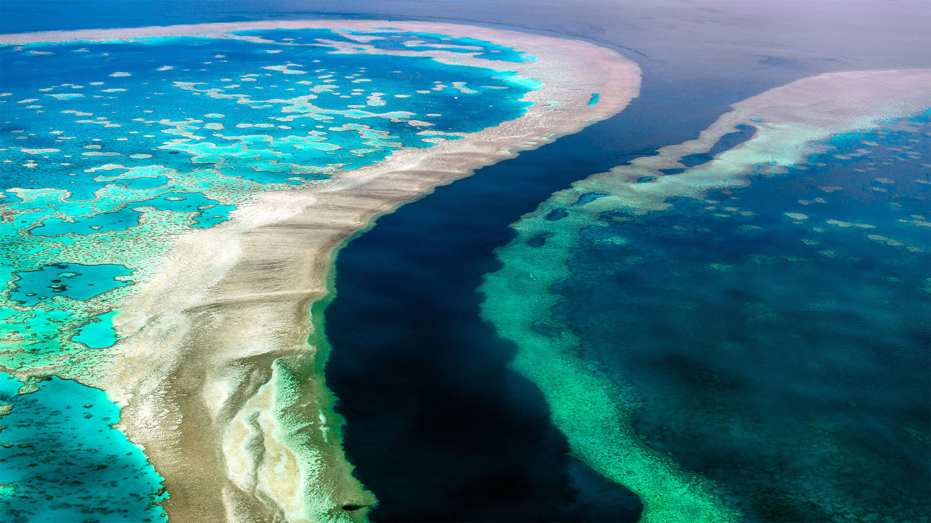
Category: Bathymetry | Habitat Mapping
The mapping project, ‘3D live habitats for the full extent of the Great Barrier Reef’, will provide, for the first time, [...]
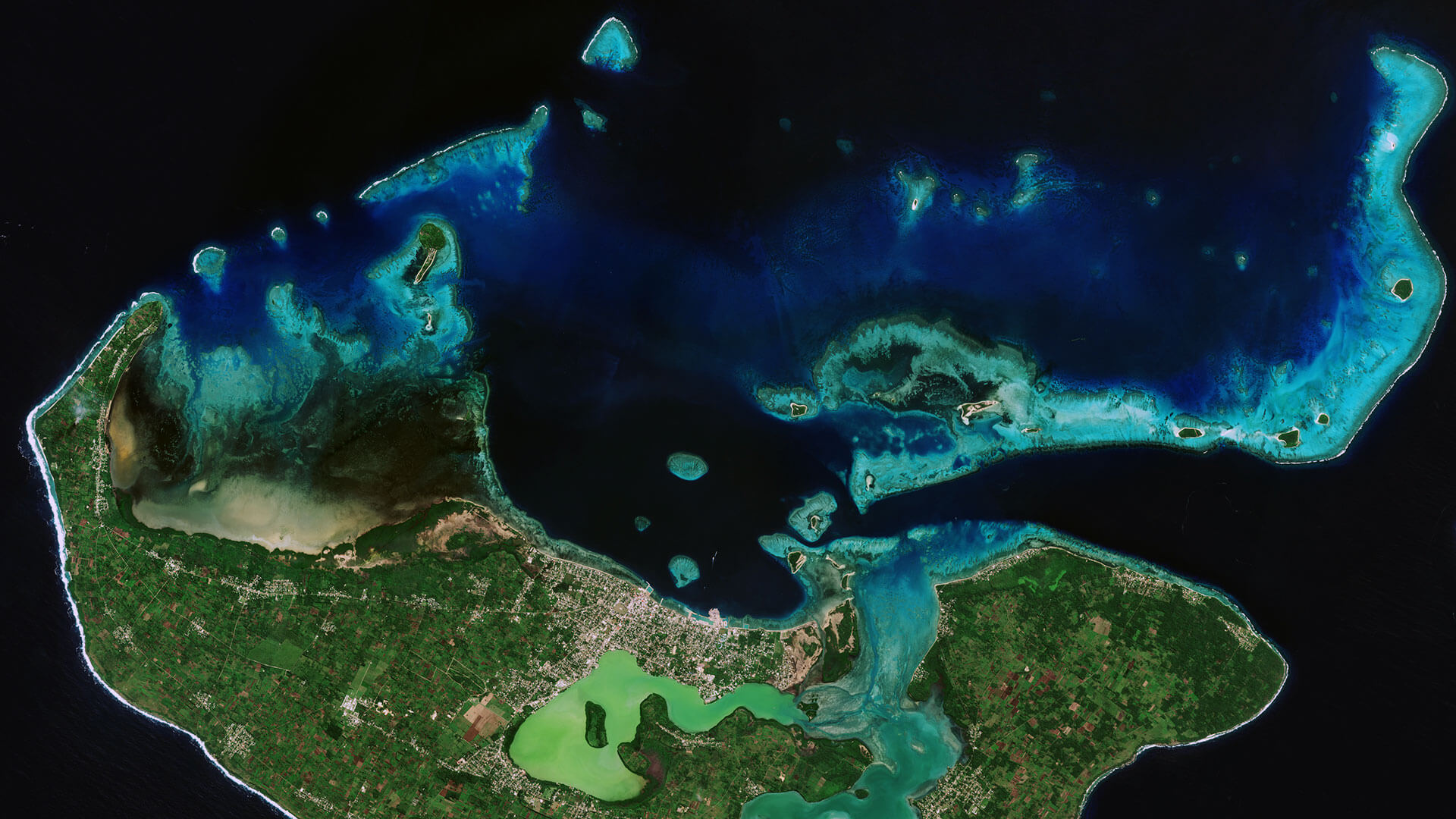
Category: Bathymetry | Coastal Management | Hydrography
Very-High Resolution Satellite-Derived Bathymetry Survey EOMAP Australia, together with project partner iXsurvey, have been contracted by Land Information New [...]
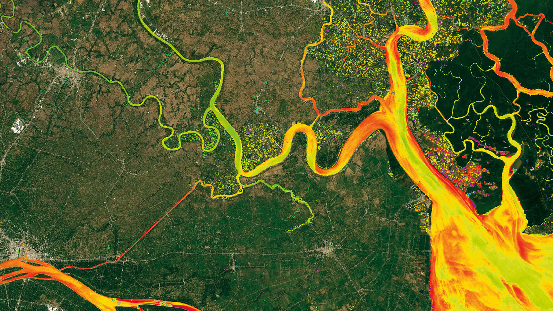
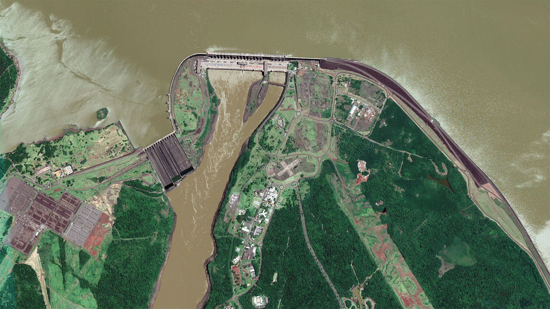
Category: Energy | R&I | Water Management | Water Quality
Monitoring Sedimentation in the Mekong Delta The international Catch-Mekong project aims to provide research and technology for the sustainable management [...]
Category: Bathymetry | Capacity Building | Hydrography
Satellite-Derived Bathymetry for European Coastal Waters EOMAP provides current high-resolution Satellite-Derived Bathymetry (SDB) for EMODnet Bathymetry, a consortium of 41 [...]
Category: Capacity Building | Water Quality
EOMAP issued the first license of its latest, cloud-based processing system for quality assessment of inland and coastal water bodies [...]

Category: Ecosystem | Engineering
The EU Water Framework Directive (2000/60/EC) and Marine Strategy Framework Directive (2008/56/EC) require evaluation of seafloor sediments and habitats every [...]

Category: Bathymetry | Ecosystem
The Environment Agency Abu Dhabi (EAD) is responsible for facilitating sustainable development, raising environmental awareness and addressing environmental issues. [...]
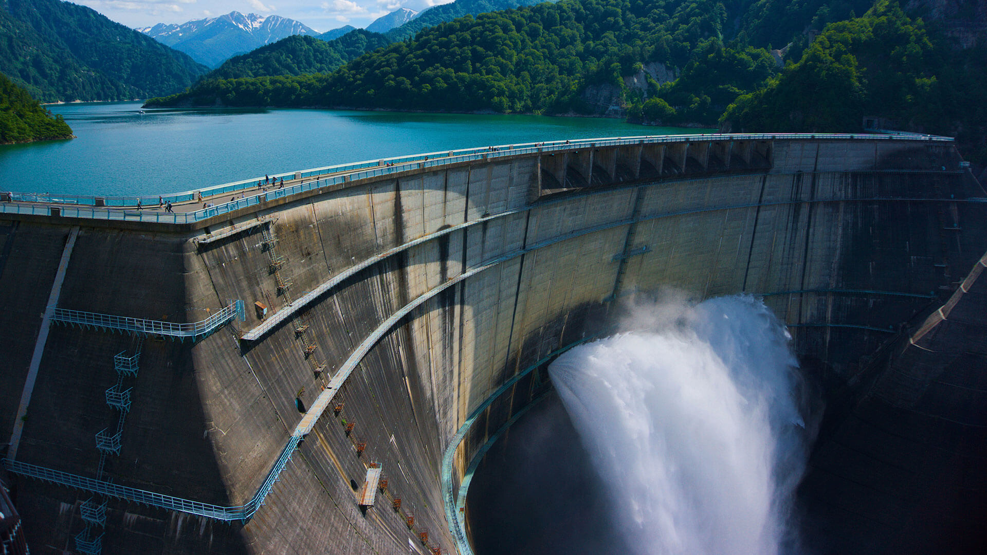
Category: Energy | R&I | Water Quality
HYPOS integrates multi-source data - for improved hydropower planning and operation Easy access to and targeted analysis of water quality [...]
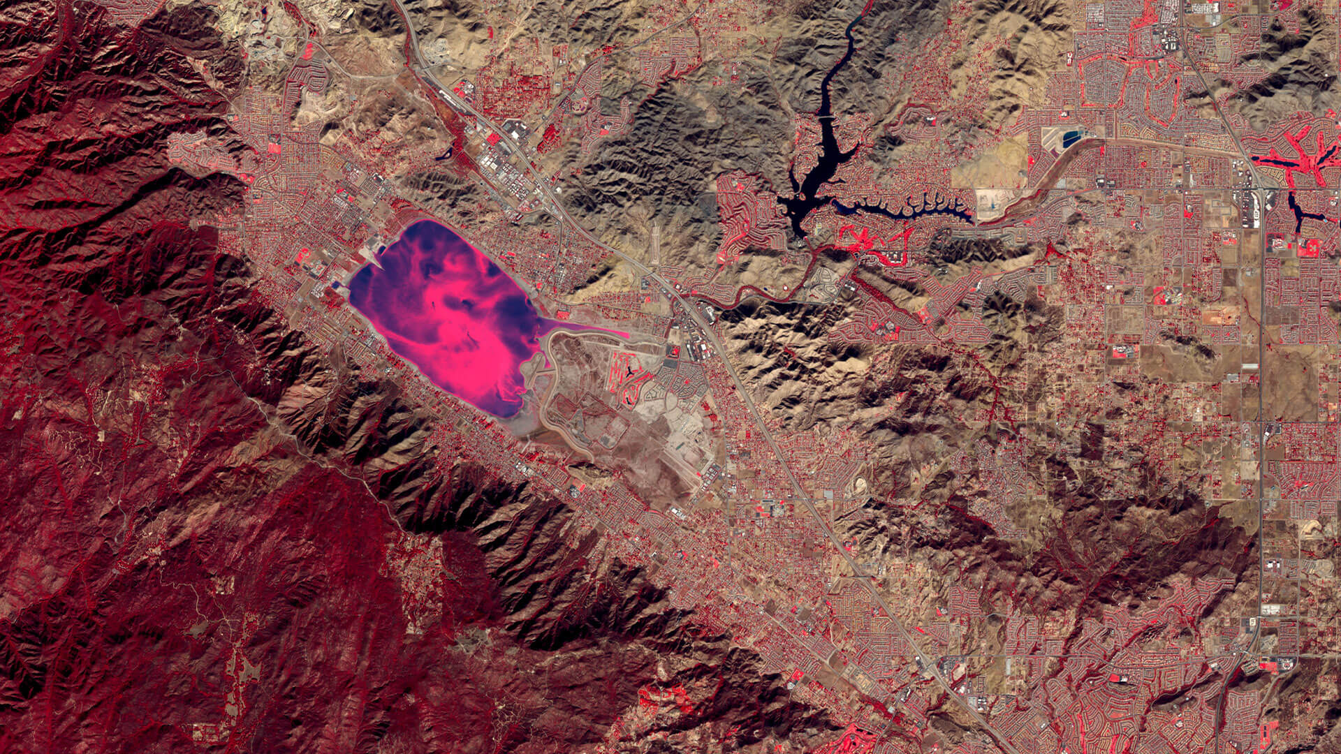
Category: Water Management | Water Quality
Long-term water quality monitoring of two different lakes in California, USA In July 2015 EOMAP established long-term water quality monitoring [...]


0
international awards
EOMAP – A FUGRO COMPANY
EOMAP OFFICES
LINKS
Copyright 2026 EOMAP GmbH & Co. KG • Imprint • Privacy Policy • Cookie settings