
Category: Bathymetry | Ecosystem | Habitat Mapping
In SmartCoast, James Cook University, EOMAP, and Fugro collaborated to develop a coastal management digital twin pilot in Torres Strait, [...]

Category: Coastal Management | Ecosystem | R&I | Water Quality
Advice4COASTS is a service platform for coastal decision makers. It simplifies the monitoring of coastal environments, supports efficient measurement campaigns [...]

Category: Ecosystem | Habitat Mapping | Water Quality
Kelp is a highly productive natural resource, providing food and shelter for marine life and the potential for carbon storage. [...]

Category: Ecosystem | R&I | Water Management | Water Quality
Identifying impact factors for lack of oxygen and biodiversity loss on rivers is challenging. River basins are complex and dynamic [...]

Category: Bathymetry | Coastal Management | Ecosystem | Habitat Mapping | R&I
COASTS is a European project led by EOMAP. The project team aims to fill important knowledge gaps through the [...]
Category: Bathymetry | Ecosystem | Habitat Mapping
This ecosystem mapping project aims to assess mangrove coverage along the entire coastline of Madagascar. Leveraging satellite data, we establish [...]

Category: Bathymetry | Ecosystem | Habitat Mapping
Since 2024, EOMAP has been part of an international consortium dedicated to mapping seagrass meadows along Italy’s entire coastline. This [...]

Category: Ecosystem | Engineering
The EU Water Framework Directive (2000/60/EC) and Marine Strategy Framework Directive (2008/56/EC) require evaluation of seafloor sediments and habitats every [...]

Category: Bathymetry | Ecosystem
The Environment Agency Abu Dhabi (EAD) is responsible for facilitating sustainable development, raising environmental awareness and addressing environmental issues. [...]
Category: Bathymetry | Ecosystem
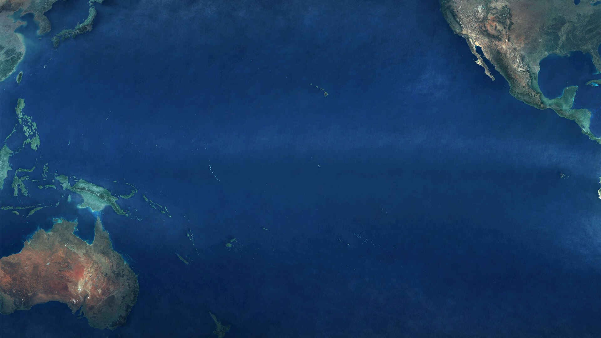
Satellite-Derived Bathymetry of Pacific Islands Many island nations in the Pacific have one thing in common: They lack high resolution [...]


0
international awards
EOMAP – A FUGRO COMPANY
EOMAP OFFICES
LINKS
Copyright 2026 EOMAP GmbH & Co. KG • Imprint • Privacy Policy • Cookie settings