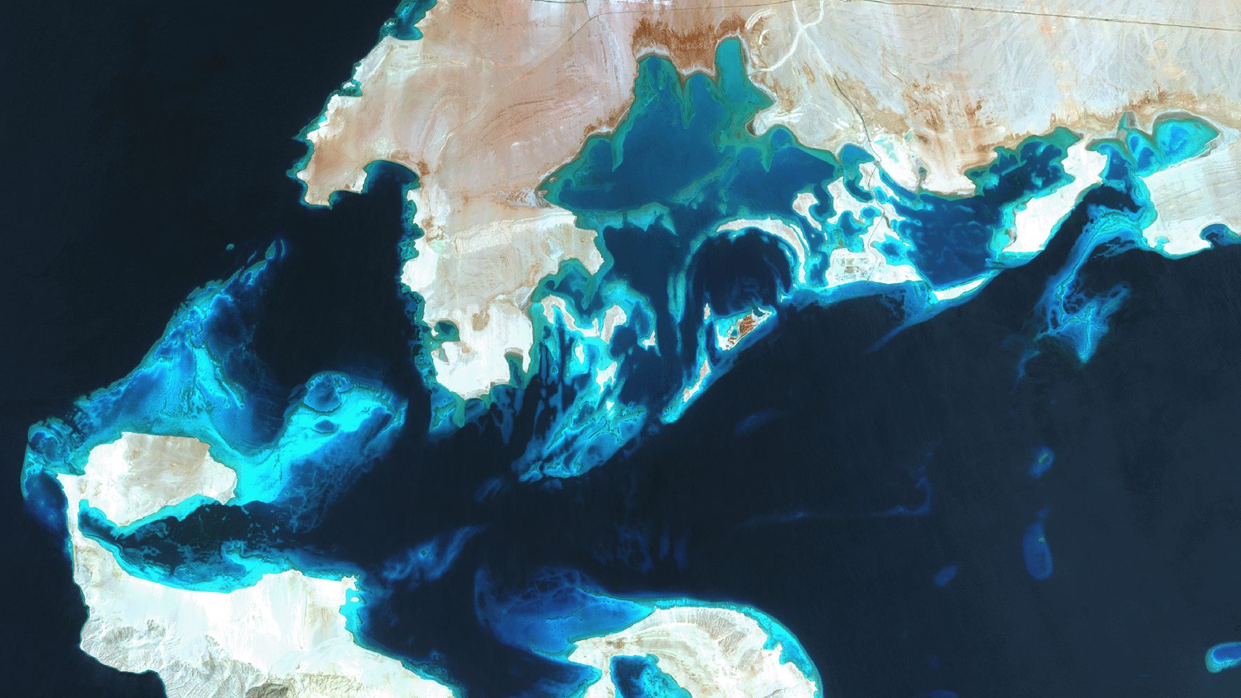
SDB Update No. 7 takes us to one of the northernmost tropical waters: The Red Sea. Learn about this topobathymetric model, for which we have combined Satellite-Derived Bathymetry (SDB) and Digital Elevation Models. Such high-resolution digital twins of coastal waters can benefit coastal protection, infrastructure planning, and safe navigation.
Ideal conditions for SDB in the Red Sea
The Red Sea is a fascinating natural asset: 25% of its mostly very clear waters are less than 50m deep, making them a perfect playground for SDB. The tropical waters are the habitat of 1,200 species and 200 types of corals. The rich diversity of the Red Sea is in part due to the 2,000 km of coral reef extending along its coastline; these fringing reefs are 5,000–7,000 years old.
In addition, the Red Sea is one of the saltiest bodies of water in the world, owing to high evaporation, low precipitation, and high temperatures in the south. This high salinity effect is reduced by the fact that the Red Sea exchanges its water with the Arabian Sea and the Indian Ocean via the Gulf of Aden.
Entire Red Sea mapped in 5 – 10 meter resolution
In late 2024, we fully mapped the shallow waters and coastal zones of the Red Sea in high resolution. For this SDB grid, we have applied Copernicus Sentinel-2 and Airbus SPOT 6/7 sensors. Here are some more facts and figures on this:
- The bathymetry data is available in a resolution of 10 meters, the land digital elevation model in 5 meters.
- Around 1,000 Sentinel-2 images were processed to increase the extent, accuracy, and quality of the SDB data.
- 37 stereo image pairs were utilised to generate a DSM/DTM covering over 8000 sqkm of the coastal terrestrial topography.
- The result is a combined topo-bathy dataset for the entire Red Sea Saudi EEZ, reaching 3km to 5km into the land and down to 20m on the seaward side
For reef protection and infrastructure planning
Such a topobathy model is fundamental for understanding coastal areas along the Red Sea. It provides
- a valuable dataset for managing and protecting the reef ecosystems and strengthening coastal resilience,
- key information for sustainable infrastructure planning along the coastline, and
- hydrographic data to foster safe navigation, given the fact that nautical charts have so far been very coarse in many places.
- In addition, the combined topo-bathy dataset will allow for (flash-)flood and sea level rise risk assessment.
Contact
Please contact shallowwater@eomap.de for SDB Services worldwide.
Or simply request a quote via our Enquiry portal.
SDB update is a Linkedin post series on Satellite-Derived Bathymetry (SDB) by EOMAP – a Fugro company. Enjoy news, facts, and figures on a bi-weekly basis!
Latest EOMAP News

Reuters bases Mekong article on EOMAP data

UKHO’s highest-ranked Satellite-Derived Bathymetry provider in 2015

Dredge plume monitoring using satellite-based turbidity mapping

Pioneering seagrass mapping at the Italian coastline in 2006

Mapping Ningaloo Reef 2009: A Breakthrough in Hyperspectral Marine Habitat Analysis

Advocating for Healthy Mountain Ecosystems
Related Posts

05 / 2026
Pioneering seagrass mapping at the Italian coastline in 2006

04 / 2026
Mapping Ningaloo Reef 2009: A Breakthrough in Hyperspectral Marine Habitat Analysis

04 / 2026
Advocating for Healthy Mountain Ecosystems

04 / 2026
Environmental monitoring for sporting events

04 / 2026
20 Years EOMAP: Advancing Earth Observation

03 / 2026
New BD & Sales Manager for the Americas

03 / 2026
Quick Facts: Lake Eyre

02 / 2026
WATCOR‑X Bathymetry Software for Navies and Hydrographic Offices

02 / 2026
Quick Facts: Ancient Lakes

01 / 2026
