
Oil spill spanning hundreds of km² at the coast of Oman: Satellite-Derived Bathymetry (SDB) reveals the critical shallow-water area to support a safe salvage operation of the grounded tanker.
Oil from a “dark” vessel endangers marine ecosystem
On 11 June, the last AIS signal from the tanker ‘Caroline Bezengi’ was recorded off the coast of Yemen. According to media reports (gCaptain, Reuters, Al Jazeera Media Network,…) the vessel had loaded almost 1 million barrels of Russian crude oil at Novorossiysk (Black Sea) and was en route to Asia.
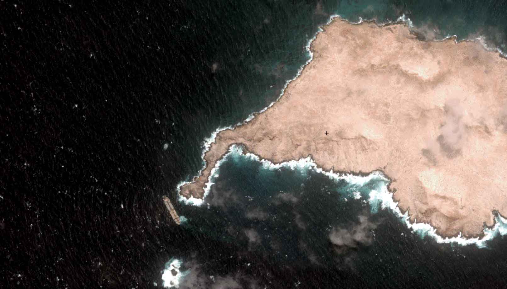
Later in June, the vessel – disabled and unmanned – ran aground on rocks southwest of Al Qibliyyah, Oman. The uninhabited island is part of the Al Hallaniyat archipelago, within a marine protected area. Nearly all of the vessel’s cargo tanks were breached.
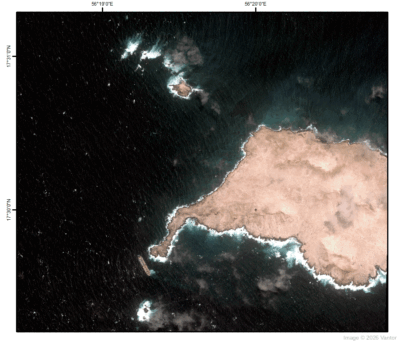
SDB overlay of Jazirat Al Qibliyyah, Oman. Source: Vantor / EOMAP.
Satellite Data Delivers Critical Shallow-Water Intelligence
Using very high resolution (VHR) satellite imagery from Vantor, EOMAP delivered SDB to Amaza Surveys on behalf of Mubarak Bridge Maritime (Mubarak Group, Dubai), which had offered to lead the salvage of the wrecked tanker. This is exactly the kind of intelligence salvage teams need to plan operations safely, particularly in insufficiently charted shallow waters.
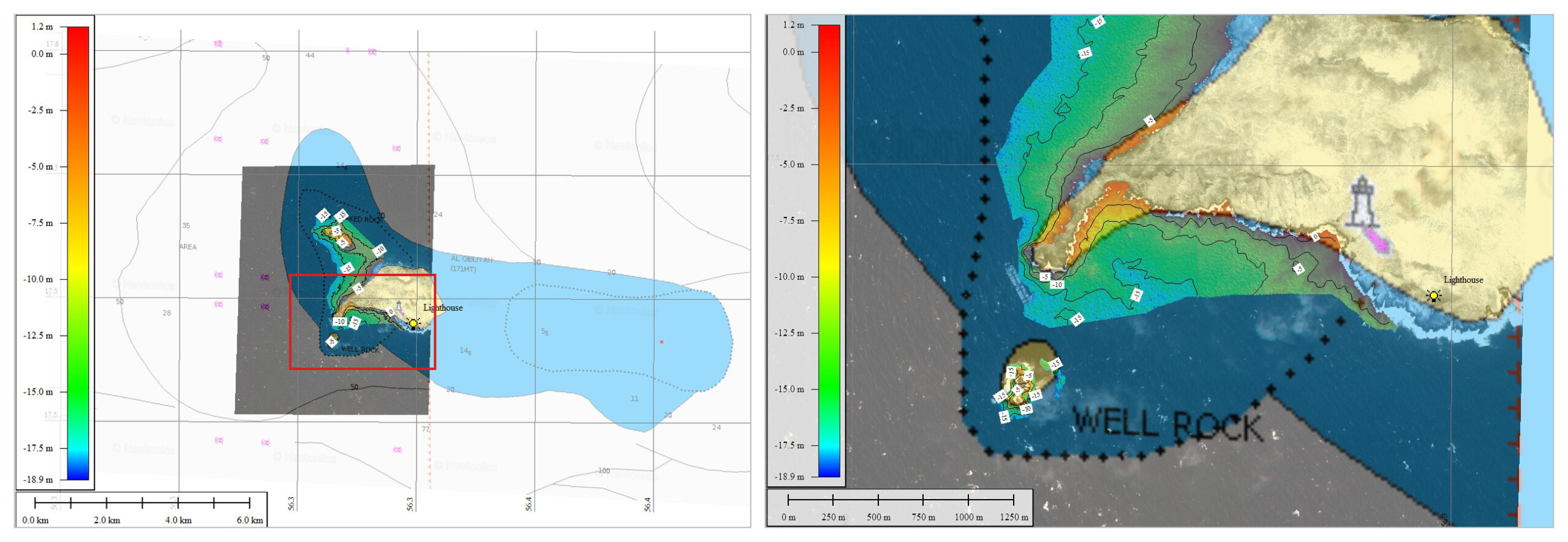
Comparison of EOMAP SDB and the online Navionics chart around Jazirat Al Qibliyyah, Oman. Source: Amaza Surveys.
With the spill now spreading across more than 600 km² (Greenpeace currently estimates even 1.000 km²), we can only hope this data reaches the right hands soon.
Satellite-derived intelligence for safe navigation and maritime surveillance
In brief: At EOMAP, we use SDB not only to provide robust, up-to-date data on critical coastal areas. It also helps us track “dark vessels”, even when AIS data is suppressed or unavailable.
Contact
- Email Kim Knauer and our coastal team to learn more about how SDB supports maritime safety and salvage planning.
- Send us your inquiry to boost your project performance.
Latest EOMAP News

Reuters bases Mekong article on EOMAP data
The Development of EOMAP’s Water Quality Platform

UNESCO Water Quality Portal launched

Launching the world’s first comprehensive global water quality atlas with UNESCO

Oman Oil Spill: SDB Mapping of Critical Shallow Waters for Safe Salvage

eoapp DIVE unterstützt die Tauchplanung
Related Posts

07 / 2026
UKHO’s highest-ranked Satellite-Derived Bathymetry provider

06 / 2026
Mapping the ‘unmappable’ Great Barrier Reef

04 / 2026
Ningaloo Reef 2009: Hyperspectral Marine Habitat Mapping

04 / 2026
20 Years EOMAP: Advancing Earth Observation

02 / 2026
WATCOR‑X Bathymetry Software for Navies and Hydrographic Offices
01 / 2026
Bathymetry in the Gulf of Mexico
10 / 2025
SDB Update #9 – Validation and Accuracy
10 / 2025
SDB Update #8 – Multisource Bathymetry
08 / 2025
SDB Update #7 – Topobathy of the Red Sea
07 / 2025

