From the new office based in the United Arab Emirates, EOMAP will serve industry partners and authorities in the Middle East, North Africa and India. Rahul Sidharth, Director of the Dubai office, will promote the full range of aquatic mapping and monitoring products by the German company.
Rahul Sidharth introduces Earth Observation services to the MENA region.
For 12 years, Rahul has been an advocate of geospatial products as well as an active part of the regional GIS and remote sensing community, both in business and academia. He holds a Bachelor in Geology from Fergusson College as well as a Master of Science in GIS and Remote Sensing from Symbiosis International University in India. After starting his professional career with ESRI India he dived deep into Business Development & Sales at Space Imaging.

Rahul Sidharth – remote sensing expert, promoting EOMAP’s producsts & services in the Middle East
“It’s a pleasure to introduce EOMAP’s mapping and monitoring products to the MENA region and the Indian subcontinent. I feel convinced that stakeholders here will value the advantages of satellite-derived decision support from our German research labs compared to conventional survey methods in terms of quality, cost effectiveness and time savings. In short, we will try to empower offshore engineers and coastal managers to take safer and faster decisions on the basis of accurate data.”
Rahul will promote EOMAP’s portfolio of aquatic mapping and monitoring services, such as bathymetry, baseline studies for dredging operations, and support for environmental impact assessment.
Connect with Rahul Sidharth at:
EOMAP Middle East office, Dubai, UAE
rahul@eomap.com
M: +971 5865 36627
T: +971 4770 4771
ENDS
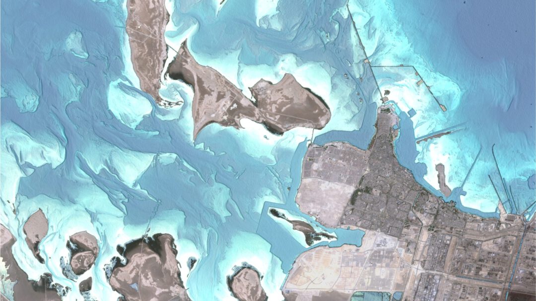
EOMAP’s global seafloor morphology map allows to identify dredging channels, shoals and seabed morphology on a level of visibility so far unknown. The image shows the eastern coastline of Saudi Arabia.
Notes to the Editor:
EOMAP provides high quality satellite-derived methods and services for mapping and monitoring coastal zones. Its team wishes to support a sustainable blue economy via a better understanding of this crucial environment. Satellite-derived data by EOMAP are part of nautical charts in the Caribbean or Pacific, serve as a baseline for all shallow waters of Abu Dhabi and help environmental scientists protect the Great Barrier Reef. Moreover, they support coastal managers and engineers around the globe. Founded in 2006, EOMAP has its headquarters near Munich, Germany and maintains offices in Australia, USA, Indonesia and in the United Arab Emirates.
eomap.com
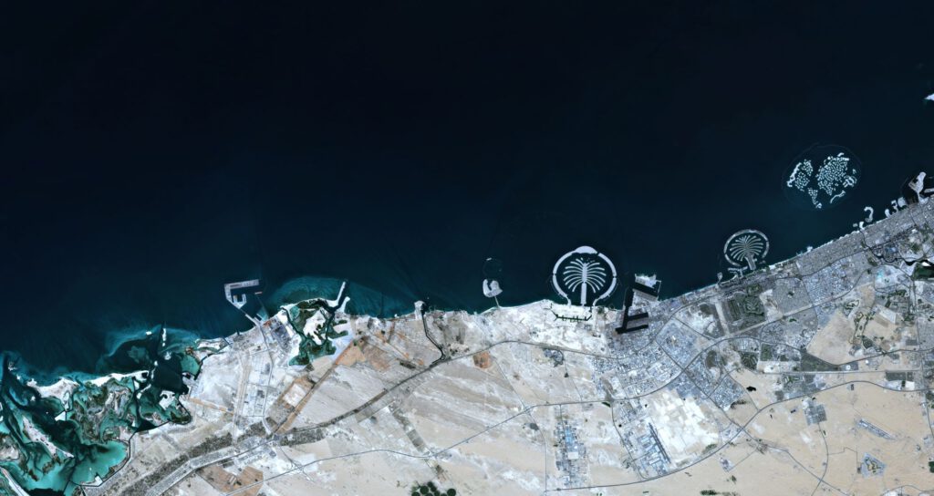
Dubai mapped from the Orbit – c/ EOMAP
For media inquiries or relevant imagery, please contact: Andrea Schmoelzer, schmoelzer@eomap.de, T: +49 (8152) 99861-10
Latest EOMAP News

Reuters bases Mekong article on EOMAP data

UKHO’s highest-ranked Satellite-Derived Bathymetry provider in 2015

Mapping the ‘unmappable’ Great Barrier Reef

Dredge plume monitoring using satellite-based turbidity mapping

Pioneering seagrass mapping at the Italian coastline in 2006

Mapping Ningaloo Reef 2009: A Breakthrough in Hyperspectral Marine Habitat Analysis
Related Posts

07 / 2026
UKHO’s highest-ranked Satellite-Derived Bathymetry provider in 2015

06 / 2026
Mapping the ‘unmappable’ Great Barrier Reef

04 / 2026
Mapping Ningaloo Reef 2009: A Breakthrough in Hyperspectral Marine Habitat Analysis

04 / 2026
20 Years EOMAP: Advancing Earth Observation

03 / 2026
New BD & Sales Manager for the Americas

02 / 2026
WATCOR‑X Bathymetry Software for Navies and Hydrographic Offices

01 / 2026
Bathymetry in the Gulf of Mexico

12 / 2025
A short recap of 2025

10 / 2025
SDB Update #9 – Validation and Accuracy

10 / 2025
