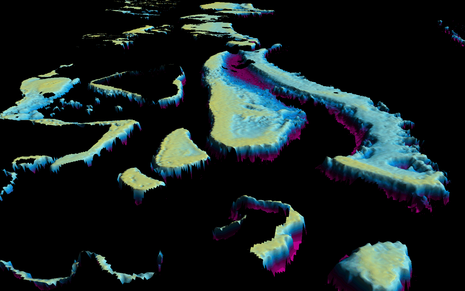
Earth observation (EO) science enthusiasts know how important and complex atmospheric and adjacency correction is for water bodies. For users of EO derivates, such as bathymetry (shown in the figure), water quality parameters, and ocean colour, atmospheric correction routines are key to ensuring standardised and high-quality outputs.
21 European scientists compare key technology
In July 2024, a scientific paper by international scientists from leading research institutions compared MIP (EOMAP’s technology), Polymer, and Acolite. The paper finds “MIP” – used in Germany’s new hyperspectral satellite mission EnMAP – superior.
EOMAP’s atmospheric correction “MIP” inside EnMAP
Hyperspectral remote sensing provides measurements over hundreds of bands from the visible to the infrared. This allows to explore the subtle optical spectral differences, especially in water. Recognising the value of this technology, a new generation of space-borne sensors for terrestrial and aquatic applications has been sent to space, EnMAP is one of them.
Being able to accurately predict water reflectances is one of, if not the most important benchmark of aquatic remote sensing algorithms. Every error in reflectance prediction propagates, thus producing errors in quantities of interest, such as: chlorophyll, turbidity, water depth etc.
The EnMAP standard product is generated by a dedicated water atmospheric correction (AC) called the Modular Inversion Program (MIP), developed by EOMAP physicists.
Intercomparison of 3 atmospheric correction (AC) methods
In the journal “Optics Express”, an international group of scientists from leading research institutions has published the first extensive assessment of the water reflectance products from EnMAP. The 21 geospatial experts evaluated EnMAP’s standard normalized water leaving reflectance over 17 water sites in the first two years of the mission. In this intercomparison exercise between three AC methods – MIP, Polymer and Acolite – MIP showed superior results: MIP-data showed very good agreement between in situ hyperspectral match-ups and EnMAP at the majority of the (17) study sites. And in the conclusion, the scientists find:
The best results were obtained for the MIP AC and demonstrated the robustness of the standard EnMAP [𝜌𝑊]𝑁 products.
By the way: MIP is also “inside” our eoapp series.
More Details
Read the full paper in the journal “Optica”.
Learn more about EnMAP here: https://www.enmap.org/
For more details, please get in touch with EOMAP’s Physics team.
Latest EOMAP News

Reuters bases Mekong article on EOMAP data

UKHO’s highest-ranked Satellite-Derived Bathymetry provider in 2015

Mapping the ‘unmappable’ Great Barrier Reef

Dredge plume monitoring using satellite-based turbidity mapping

Pioneering seagrass mapping at the Italian coastline in 2006

Mapping Ningaloo Reef 2009: A Breakthrough in Hyperspectral Marine Habitat Analysis
Related Posts

07 / 2026
UKHO’s highest-ranked Satellite-Derived Bathymetry provider in 2015

06 / 2026
Mapping the ‘unmappable’ Great Barrier Reef

06 / 2026
Dredge plume monitoring using satellite-based turbidity mapping

04 / 2026
Mapping Ningaloo Reef 2009: A Breakthrough in Hyperspectral Marine Habitat Analysis

04 / 2026
Advocating for Healthy Mountain Ecosystems

04 / 2026
Environmental monitoring for sporting events

04 / 2026
20 Years EOMAP: Advancing Earth Observation

03 / 2026
New BD & Sales Manager for the Americas

03 / 2026
Quick Facts: Lake Eyre

02 / 2026
