Let’s celebrate this years World Rivers Day 2025 – a moment to recognise rivers as the lifelines of our planet. They provide water, nourish ecosystems, support communities, and drive economies across the globe. However many rivers face growing challenges: pollution, overuse, habitat degradation, and climate change impacts.
We want to highlight how satellite-derived solutions can support the sustainable management of rivers worldwide.
Satellite monitoring provides clear, consistent insights that benefit stakeholders from local to global levels, helping to:
- Monitor water quality and sediment transport
- Map floodplains, erosion, and river morphology
- Support habitat conservation and ecosystem health
- Provide globally comparable, validated datasets for decision-making
River Monitoring Projects Around the World
Our international river projects already show how satellite data can contribute to climate resilience, water quality monitoring, and hydrology solutions:
- Zambezi Basin – Satellite data on water quality and discharge now supports ZAMCOM’s regional platform, closing gaps where ground stations are scarce.
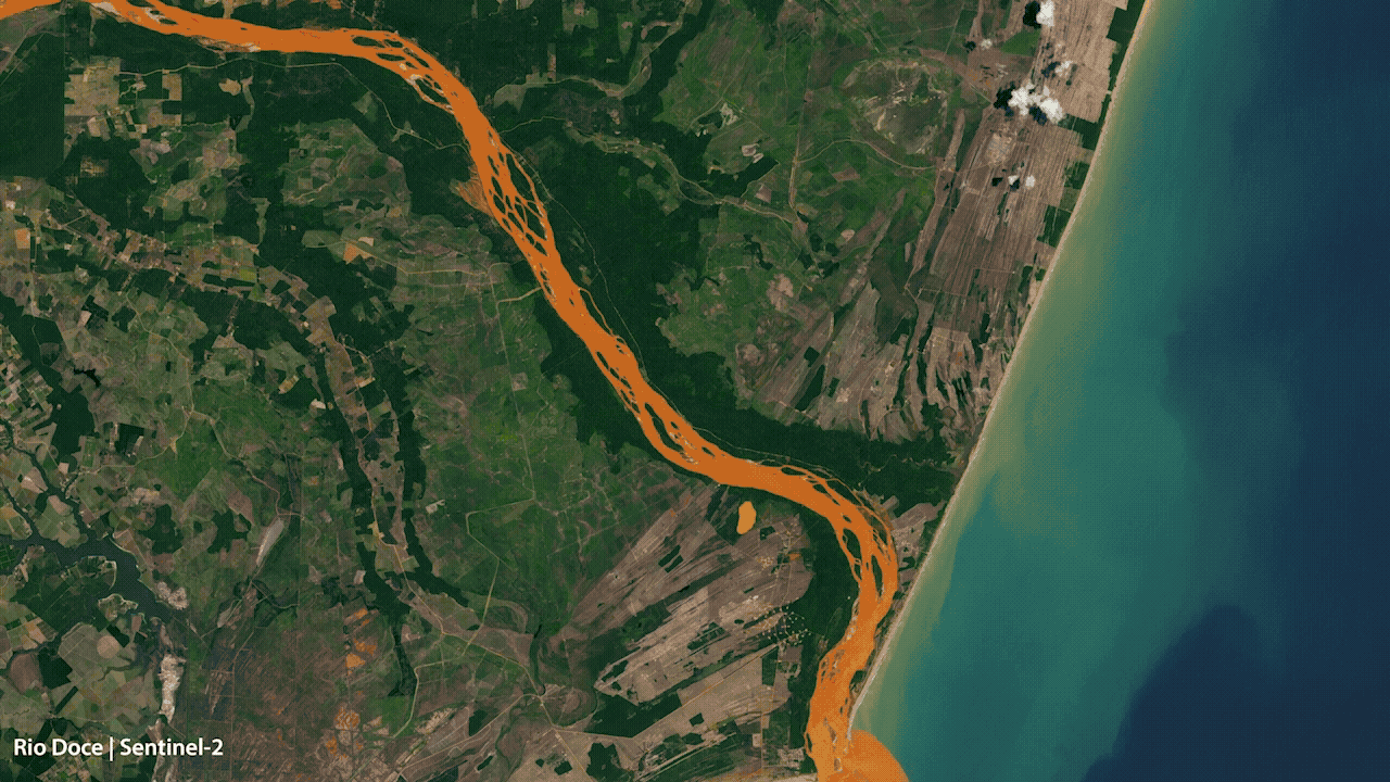
- Rio Doce, Brazil – After the 2015 dam collapse, near real-time turbidity maps traced the 650 km mudflow, helping assess ecological impacts and guide remediation.
- Mekong Delta – Long-term image series reveal erosion, salinity, and shifting morphology, supporting resilience strategies in one of the world’s most vulnerable deltas.
- Elbe River, Germany – High-resolution monitoring of turbidity and algae provides early warnings of oxygen loss, supporting biodiversity and fish migration pathways.
For more details, please get in touch with the water quality team
Learn more about our river-focused solutions
Latest EOMAP News


Related Posts

03 / 2026
New BD & Sales Manager for the Americas

03 / 2026
Quick Facts: Lake Eyre

02 / 2026
Quick Facts: Ancient Lakes

01 / 2026
Space-based Intelligence for Clean Energy

01 / 2026
Bathymetry in the Gulf of Mexico

01 / 2026
Pro-active hydropower management in winter

12 / 2025
From Climate to Nature and Biodiversity: Insights on COP30

12 / 2025
Water Crisis in Iran – Lessons to be learned

11 / 2025
Italian Webinar: Water Quality Monitoring from Space

11 / 2025
