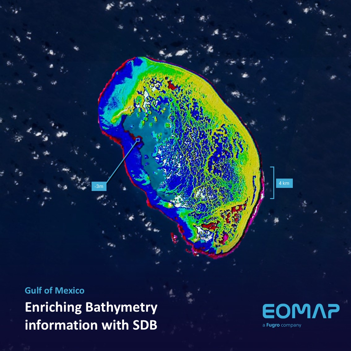
The Scorpion Reef, in Spanish “Arrecife Alacranes”, is the largest atoll in the southern Gulf of Mexico and a designated National Park. EOMAP has now mapped this region using Satellite-Derived Bathymetry (SDB).
Mapping a biodiversity hotspot
This largest reef of the region is home to an extraordinary marine ecosystem: With five islets and at least 34 hard coral species, it serves as a sanctuary for numerous kinds of birds, fish, and turtles. Unfortunately, like many other biodiversity hotspots, Scorpion Reef faces threats from factors, such as illegal fishing and unregulated tourism.
Space-based data on water depth
Only recently, our team processed 290 km² of the region around Scorpion Reef using Satellite-Derived Bathymetry (SDB) workflows. This approach provides detailed insights into water depths across the atoll without the need for costly or invasive surveys. The data generated are valuable decision-support for conservation and monitoring efforts.
For this 10-m dataset, our colleagues analysed satellite scenes of Sentinel-2. “10-metre resolution” means that the smallest area mapped is 10x10m size – which we also applied for extended areas such as the Bahamas.
The benefits of SDB datasets
Like at Scorpion Reef, this space-based mapping technology offers several benefits for decision makers in coastal environments:
- Enhanced monitoring: Continuous monitoring and update of sandy seabed and beaches
- Fills bathymetric data gaps: Depth information in areas which are not sufficiently charted
- Cost-effective and scalable: No need for extensive fieldwork, satellite imagery enables large-area coverage quickly
- Supports conservation: Provides actionable data for managing and protecting marine ecosystems
- Non-intrusive and safe: Ideal for remote or protected regions where traditional surveys are challenging
Let’s connect
For other applications, especially in coastal engineering, we can increase the spatial resolution of SDB grids to submeter levels of detail.
Please contact our US office or our shallowwater team for SDB services worldwide.
Latest EOMAP News


Related Posts

03 / 2026
Quick Facts: Lake Eyre

02 / 2026
WATCOR‑X Bathymetry Software for Navies and Hydrographic Offices

02 / 2026
Quick Facts: Ancient Lakes

01 / 2026
Space-based Intelligence for Clean Energy

12 / 2025
From Climate to Nature and Biodiversity: Insights on COP30

12 / 2025
Water Crisis in Iran – Lessons to be learned

11 / 2025
Italian Webinar: Water Quality Monitoring from Space

11 / 2025
Projektstart SEAGUARD

10 / 2025
SDB Update #9 – Validation and Accuracy

10 / 2025
