August 2024 – Beach recovery is in the focus of EOMAP’s talk at the ASBPA – American Shore and Beach Preservation Association Conference 2024 (26-29 August) in Texas. The satellite-based mapping solution perfectly matches this year’s ASBPA conference motto: “Wrangling the Waves of Change: Adapting to Coastal Dynamics”:
Access the presentation here at the HYDRO 2024 conference site.
Read more about Shallow Water Surveys and relevant use cases here.
Access eoapp SDB-Online – EOMAP’s online solution for creating satellite-based bathymetry maps.
Contact
For further questions, please get in touch with:
Edward Albada – Principal EOMAP USA – North America and Caribbean, or with
Dr. Kim Knauer – Project & Innovation Manager at EOMAP.
Latest EOMAP News

Reuters bases Mekong article on EOMAP data

UKHO’s highest-ranked Satellite-Derived Bathymetry provider in 2015

Dredge plume monitoring using satellite-based turbidity mapping

Pioneering seagrass mapping at the Italian coastline in 2006

Mapping Ningaloo Reef 2009: A Breakthrough in Hyperspectral Marine Habitat Analysis

Advocating for Healthy Mountain Ecosystems
Related Posts

07 / 2026
UKHO’s highest-ranked Satellite-Derived Bathymetry provider in 2015

05 / 2026
Pioneering seagrass mapping at the Italian coastline in 2006

04 / 2026
Mapping Ningaloo Reef 2009: A Breakthrough in Hyperspectral Marine Habitat Analysis

04 / 2026
Environmental monitoring for sporting events

04 / 2026
20 Years EOMAP: Advancing Earth Observation

03 / 2026
New BD & Sales Manager for the Americas

02 / 2026
WATCOR‑X Bathymetry Software for Navies and Hydrographic Offices

01 / 2026
Bathymetry in the Gulf of Mexico

12 / 2025
A short recap of 2025

12 / 2025

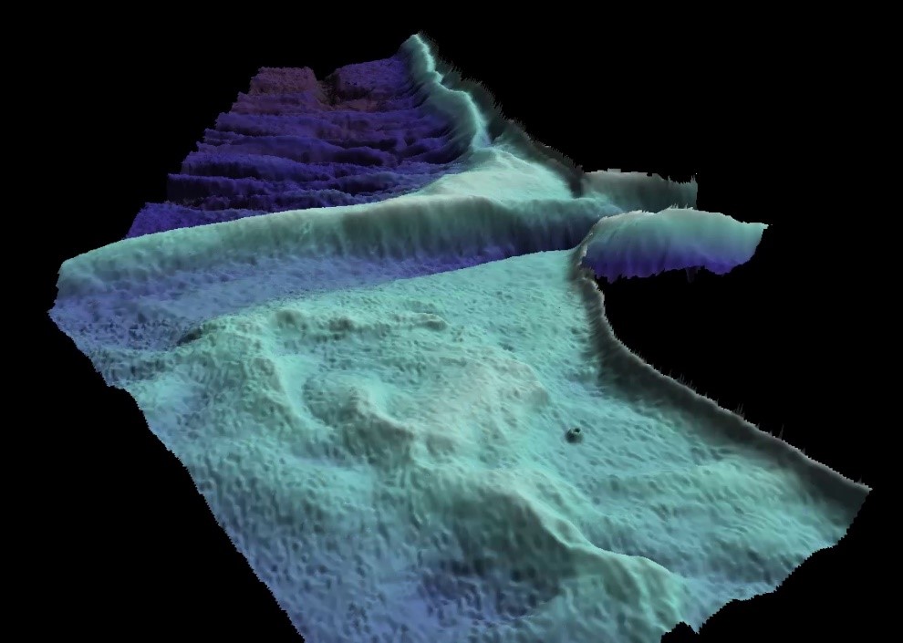
“Analysing nearshore change at Coquina Beach following Hurricane Idalia” is the title of EOMAP’s presentation. Coastal engineer Edward Albada and Innovation Manager Kim Knauer outline how EOMAP physics-based Satellite-Derived Bathymetry (SDB) helped assess the beach and nearshore change after nourishment measures in 2021 and the hurricane “Idalia” in Florida in August 2023.
For this purpose, two (a pre- and two post-hurricane) SDB snapshots from Planet’s SkySat imagery in 3m horizontal resolution were compared against APTIM’s single sideband (SSB) profile data.
The results indicate
📍 physics-based SDB as a viable option for local and federal regulatory agencies
📍 who are interested in rapid, cost-effective, and accurate bathymetric surveys following episodic storm events.
📍 The SDB comparison allows for a direct assessment of spatial changes within the domain, including sandbar dynamics and smothering of hard-bottom features.
📍 The comparison in dense spatial grids also allows for a better understanding of the nearshore dynamics and beach response for potential application in morphological modeling applications.