In this SDB Update No. 6, we are focusing on topobathy models – essential tools for tracking coastal change with high precision. By merging land elevation and bathymetric data into seamless grids, topobathy models provide a full picture of coastal dynamics both above and below sea level.
Topobathy data can guide adaptive responses
According to the IPCC, nearly 11% of the global population lives in low-lying coastal zones less than 10 meters above sea level. This makes them especially vulnerable to flooding and permanent inundation.
Accurate, high-resolution topo-bathy data is essential not only for modeling these risks, but also for guiding adaptive responses in vulnerable areas. However, when powered by Satellite-Derived Bathymetry (SDB), they also enable
- regular, scalable monitoring of shorelines,
- nearshore morphologies,
- and underwater features.
These capabilities are especially critical given that climate change accelerates sea level rise and intensifies storm-driven erosion.
Topobathy models up to 50cm-resolution
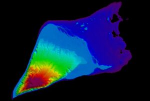
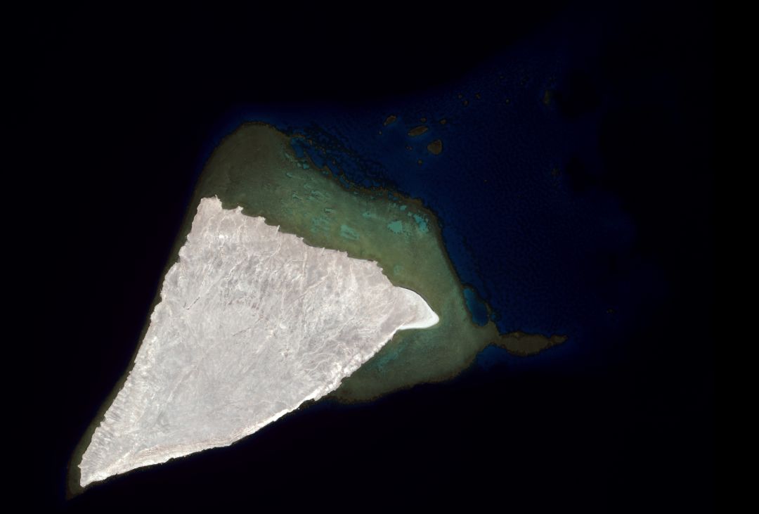
At EOMAP, we can construct use case tailored satellite-derived topobathy models which range from 10m up to sub-meter spatial resolution for either or both the topography AND the bathymetry. Not only are these models insightful and informational but also mesmerizing to look at. The image shows Shusha Island in Saudi Arabia, an island in midst coral reefs of the Red Sea.
Contact
Please contact shallowwater@eomap.de for SDB Services worldwide.
Or simply request a quote via our Enquiry portal.
*SDB update is a Linkedin post series on Satellite-Derived Bathymetry (SDB) by EOMAP – a Fugro company. Enjoy news, facts, and figures on a bi-weekly basis!
Latest EOMAP News


Related Posts

02 / 2026
WATCOR‑X Bathymetry Software for Navies and Hydrographic Offices

01 / 2026
Bathymetry in the Gulf of Mexico

12 / 2025
From Climate to Nature and Biodiversity: Insights on COP30

11 / 2025
Projektstart SEAGUARD

10 / 2025
SDB Update #9 – Validation and Accuracy

10 / 2025
New Storymap: Bathing Water Monitoring from Space

10 / 2025
SDB Update #8 – Multisource Bathymetry

08 / 2025
SDB Update #7 – Topobathy of the Red Sea

07 / 2025
SDB Update #5 – Storymap on Satellite-Derived Bathymetry

06 / 2025
